Gardene på Roset
Gardene på Roset is in Vestre Toten Municipality, Innlandet. Gardene på Roset is situated nearby to the church Nordåsen bedehus, as well as near the sports venue Lønnberget hoppsenter.| Tap on a place to explore it |
Places of Interest Nearby
Highlights include Raufoss Station and Raufoss Church.
Raufoss Station
Railway station
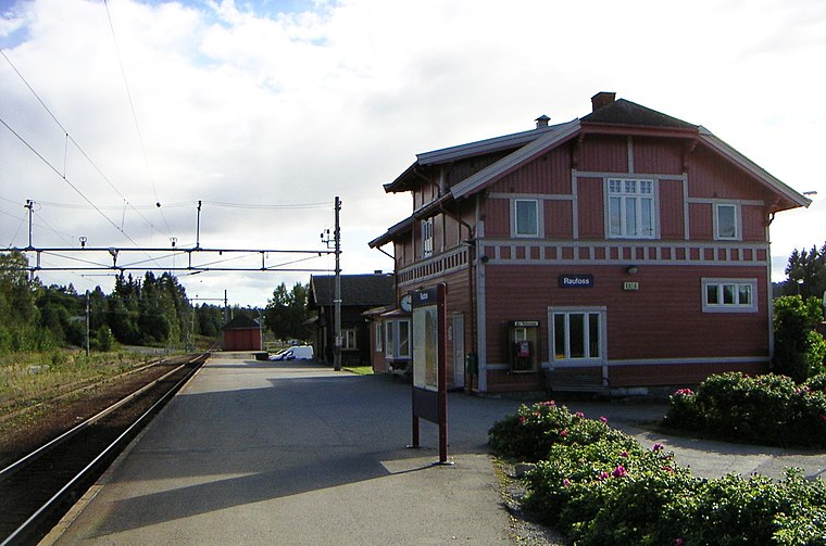
Photo: Wikimedia, CC BY-SA 2.5.
Raufoss Station is located on the Gjøvik Line at Raufoss in Vestre Toten Municipality, Norway. The station was opened on 23 December 1901 as Raufossen, and received its current name on 28 November 1902. It is served by the R30 line by Vy Gjøvikbanen. Raufoss Station is situated 2½ km northeast of Gardene på Roset.
Raufoss Church
Church

Photo: Wikimedia, CC BY-SA 2.5.
Raufoss Church is a parish church of the Church of Norway in Vestre Toten Municipality in Innlandet county, Norway. It is located in the town of Raufoss. Raufoss Church is situated 2½ km northeast of Gardene på Roset.
Lauvhøgda
Peak

Photo: Mixmaster, CC BY-SA 4.0.
Lauvhøgda is a peak, which is situated 3½ km southwest of Gardene på Roset.
Gardene på Roset
- Type: Sign
- Categories: information and tourism
- Location: Vestre Toten Municipality, Innlandet, Norway, Nordic countries, Europe
- View on OpenStreetMap
Latitude
60.71259° or 60° 42′ 45″ northLongitude
10.5768° or 10° 34′ 37″ eastOpen location code
9FGGPH7G+2POpenStreetMap ID
node 9998923916OpenStreetMap feature
tourism=information
This page is based on OpenStreetMap, Wikidata, and Wikimedia Commons.
We’d love your help improving our open data sources. Thank you for contributing.
Satellite Map
Discover Gardene på Roset from above in high-definition satellite imagery.
Notable Places Nearby
Highlights include Nordåsen bedehus and Lønnberget hoppsenter.
Nearby Places
Explore places such as Nedre Roset and Gr5-29.
Norway: Must-Visit Destinations
Delve into Oslo, Bergen, Trondheim, and Tromsø.
Curious Places to Discover
Uncover intriguing places from every corner of the globe.
About Mapcarta. Data © OpenStreetMap contributors and available under the Open Database License". Text is available under the CC BY-SA 4.0 license, except for photos, directions, and the map. Photo: Ximonic, CC BY-SA 3.0.