Sadarnagar
Sadarnagar is an electrical substation in Bhavnagar, Gujarat. Sadarnagar is situated nearby to Shriji Hospital, as well as near KD Manek Memorial Park.| Tap on a place to explore it |
Places of Interest Nearby
Highlights include Bhavnagar Airport and Bhavnagar Terminus railway station.
Bhavnagar Airport
Aerodrome

Photo: Trinidade, CC BY-SA 3.0.
Bhavnagar Airport is a domestic airport serving the city of Bhavnagar, Gujarat, India. It is located at Shubhashnagar, 4 km south-east from the city centre and 9 km south from the Bhavnagar Port. It covers an area of 295 acres at an elevation of 6 metres. Bhavnagar Airport is situated 3½ km east of Sadarnagar.
Bhavnagar Terminus railway station
Railway station
Bhavnagar Terminus railway station is a railway station serving Bhavnagar town, in Bhavnagar district of the Indian state of Gujarat. It is under Bhavnagar railway division of Western Railway zone of Indian Railways. Bhavnagar Terminus railway station is situated 3 km northwest of Sadarnagar.
Bhavnagar Para railway station
Railway station
Bhavnagar railway station is a small railway station in Bhavnagar district, Gujarat. Its code is BVP. It serves Bhavnagar city. The station consists of two platforms. Bhavnagar Para railway station is situated 4 km northwest of Sadarnagar.
Places in the Area
Nearby places include Bhavnagar.
Bhavnagar
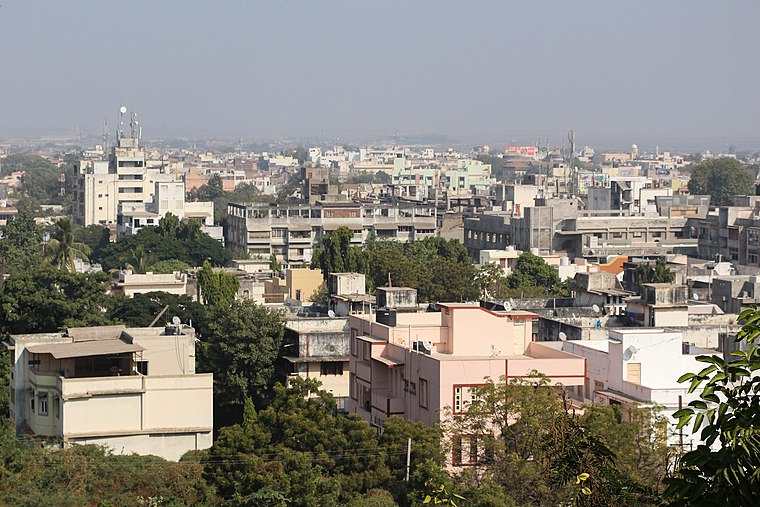
Photo: Bgag, CC BY-SA 3.0.
Bhavnagar is a city in the Saurashtran peninsula of Gujarat, India, known as an industrial hub excelling in salt and jewellery production, and is associated with Mahatma Gandhi, who went to university here.
Sadarnagar
- Type: Electrical substation
- Category: industry
- Location: Bhavnagar, Gujarat, Western India, India, South Asia, Asia
- View on OpenStreetMap
Latitude
21.75631° or 21° 45′ 23″ northLongitude
72.15231° or 72° 9′ 8″ eastOpen location code
7JHJQ542+GWOpenStreetMap ID
way 1005263532
This page is based on OpenStreetMap, Wikidata, and Wikimedia Commons.
We’d love your help improving our open data sources. Thank you for contributing.
Satellite Map
Discover Sadarnagar from above in high-definition satellite imagery.
Notable Places Nearby
Highlights include Shriji Hospital and KD Manek Memorial Park.
Nearby Places
Explore places such as Sheth H J law college and Nandalaya Haveli.
Gujarat: Must-Visit Destinations
Delve into Ahmedabad, Dadra and Nagar Haveli, Surat, and Vadodara.
Curious Electrical Substations to Discover
Uncover intriguing electrical substations from every corner of the globe.
About Mapcarta. Data © OpenStreetMap contributors and available under the Open Database License". Text is available under the CC BY-SA 4.0 license, except for photos, directions, and the map. Photo: Bgag, CC BY-SA 3.0.