Sheep’s Food District
Sheep’s Food District is a retail building in Orland Township, Cook, Illinois which is located on West 159th Street. Sheep’s Food District is situated nearby to Christian Hills Church, as well as near the playground Elm Place Tot Lot.| Tap on a place to explore it |
- Opening hours: Monday—Friday 2:00 PM—11:00 PM and Saturday—Sunday 11:00 AM—midnight
- Email: sheepsfooddistrict@gmail.com
- Type: Retail building
- Address: 8888 West 159th Street, Orland Park, IL 60462
- Wheelchair access: yes
Places of Interest Nearby
Highlights include Orland Square Mall and Orland Park Public Library.
Orland Square Mall
Shopping center
Orland Square is a shopping mall located in Orland Park, Illinois, United States. It is the second largest mall in the Chicago Southland, the south and southwest suburbs of Chicago, covering an area of 1,229,884 sq ft. Orland Square Mall is situated 1½ miles northwest of Sheep’s Food District.
Orland Park Public Library
Library
The Orland Park Public Library serves the residents of Orland Park, Illinois. Orland Park is a southwest suburb of Chicago. Currently the library services approximately 58,590 residents. Orland Park Public Library is situated 1½ miles northwest of Sheep’s Food District.
153rd Street/Orland Park station
Railway station
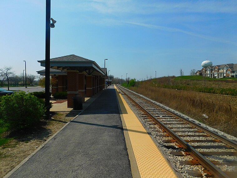
Photo: Wikimedia, CC BY-SA 2.0.
153rd Street/Orland Park is one of three stations on Metra's SouthWest Service in Orland Park, Illinois. The station is 25.2 miles away from Chicago Union Station, the northern terminus of the line. 153rd Street/Orland Park station is situated 2 miles west of Sheep’s Food District.
Places in the Area
Nearby places include Orland Hills and Orland Park.
Orland Hills
Village
Orland Hills is a village in Cook County, Illinois, United States. Per the 2020 census, the population was 6,893, and as of 2022, the total number of households was 2,330.
Orland Park
Town

Photo: NASA, Public domain.
Orland Park is a village in Cook County, Illinois, United States, with a small portion in Will County. It is a suburb of Chicago. Per the 2020 census, Orland Park had a population of 58,703. Orland Park is situated 2 miles northwest of Sheep’s Food District.
Tinley Park

Photo: Wikimedia, CC BY-SA 2.0.
Tinley Park is a village in Cook and Will counties in the U.S. state of Illinois. The population was 55,971 at the 2020 census. It is a suburb in the Chicago metropolitan area.
Sheep’s Food District
- Category: building
- Location: Orland Township, Cook, Illinois, Midwest, United States, North America
- View on OpenStreetMap
Latitude
41.60197° or 41° 36′ 7″ northLongitude
-87.83551° or 87° 50′ 8″ westOpen location code
86HJJ527+QQOpenStreetMap ID
way 1007167163OpenStreetMap feature
building=retailOpenStreetMap attribute
wheelchair=yes
This page is based on OpenStreetMap, Wikidata, and Wikimedia Commons.
We’d love your help improving our open data sources. Thank you for contributing.
Satellite Map
Discover Sheep’s Food District from above in high-definition satellite imagery.
Notable Places Nearby
Highlights include Christian Hills Church and Elm Place Tot Lot.
Nearby Places
Explore places such as Joe Trucker and Mazda of Orland Park.
Illinois: Must-Visit Destinations
Delve into Chicago, Springfield, Rockford, and Loop.
Curious Retail Buildings to Discover
Uncover intriguing retail buildings from every corner of the globe.
About Mapcarta. Data © OpenStreetMap contributors and available under the Open Database License". Text is available under the CC BY-SA 4.0 license, except for photos, directions, and the map. Photo: Rastapopulous, CC BY-SA 3.0.