Parque Camino del Olivo
Parque Camino del Olivo is a park in Meco, Madrid, Community of Madrid. Parque Camino del Olivo is situated nearby to the square Finca del Comandante, as well as near Plaza Nueva Castilla.| Tap on a place to explore it |
Places of Interest Nearby
Highlights include Church of Nuestra Señora de la Asunción and Meco.
Church of Nuestra Señora de la Asunción
Church
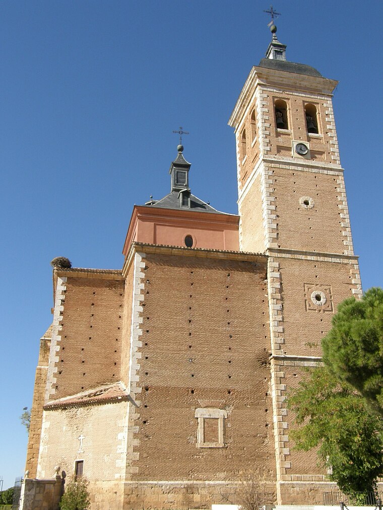
Photo: EventusBonus, CC BY-SA 3.0.
The Church of Nuestra Señora de la Asunción is a church and parish in Meco, Spain. The church was added to the Bien de Interés Cultural registry in 1982. Church of Nuestra Señora de la Asunción is situated 1 km northwest of Parque Camino del Olivo.
Meco
Railway station
 Meco is a railway station, which is situated 2½ km southeast of Parque Camino del Olivo.
Parroquia Santa Teresa de Jesús
Church

Photo: Oilisab, CC BY-SA 4.0.
Parroquia Santa Teresa de Jesús is a church, which is situated 4 km northeast of Parque Camino del Olivo.
Places in the Area
Nearby places include Camarma de Esteruelas and Azuqueca de Henares.
Camarma de Esteruelas
Village

Photo: Wikimedia, CC BY-SA 4.0.
Camarma de Esteruelas is a Spanish village and municipality in the autonomous community of Madrid in central Spain, 35 km northeast of the city of Madrid and 5 km north of Alcalá de Henares. Camarma de Esteruelas is situated 5 km west of Parque Camino del Olivo.
Azuqueca de Henares
Town

Photo: Wikimedia, CC BY-SA 3.0.
Azuqueca de Henares is a municipality located in the province of Guadalajara, Castile-La Mancha, Spain. According to the 2013 census, the municipality had a population of 34,685 inhabitants. The mayor of Azuqueca is José Luis Blanco. Azuqueca de Henares is situated 5 km northeast of Parque Camino del Olivo.
Ciudad del Aire (Alcalá de Henares)
Neighborhood
 Ciudad del Aire (Alcalá de Henares) is a neighborhood, which is situated 6 km southwest of Parque Camino del Olivo.
Parque Camino del Olivo
- Type: Park
- Category: recreation area
- Location: Meco, Madrid, Community of Madrid, Central Spain, Spain, Iberia, Europe
- View on OpenStreetMap
Latitude
40.54858° or 40° 32′ 55″ northLongitude
-3.32056° or 3° 19′ 14″ westOpen location code
8CGRGMXH+CQOpenStreetMap ID
way 1009886733OpenStreetMap feature
leisure=park
This page is based on OpenStreetMap, Wikidata, and Wikimedia Commons.
We’d love your help improving our open data sources. Thank you for contributing.
Satellite Map
Discover Parque Camino del Olivo from above in high-definition satellite imagery.
Notable Places Nearby
Highlights include Finca del Comandante and Ciudad de la Luz.
Nearby Places
Explore places such as Escuela de Educación Vial and Cº Olivo - Av. Luz.
Community of Madrid: Must-Visit Destinations
Delve into Madrid, Alcalá de Henares, Getafe, and Aranjuez.
Curious Parks to Discover
Uncover intriguing parks from every corner of the globe.
About Mapcarta. Data © OpenStreetMap contributors and available under the Open Database License". Text is available under the CC BY-SA 4.0 license, except for photos, directions, and the map. Photo: Wikimedia, CC0.