The Salvation Army (Hostal)
The Salvation Army (Hostal) is a building in Bradley, North East Lincolnshire, England which is located on Eleanor Street. The Salvation Army (Hostal) is situated nearby to the health club Samurai Hearts Martial Arts Academy, as well as near St Mary’s Church, Grimsby.| Tap on a place to explore it |
Places of Interest Nearby
Highlights include St Mary’s Church, Grimsby and Ross Tiger.
St Mary’s Church, Grimsby
Church

Photo: Allan chapman, CC BY-SA 2.0.
St Mary's Church or its full name St Mary on the Sea Church is a Roman Catholic Parish Church in Grimsby, Lincolnshire. It was built from 1880 to 1883. St Mary’s Church, Grimsby is situated 840 feet east of The Salvation Army (Hostal).
Ross Tiger
Ship

Photo: Dornsby, Public domain.
Ross Tiger is a traditional side-winder fishing trawler that was converted into a museum ship in 1992. She is currently berthed in Alexandra Dock at her home port of Grimsby, close to the site of the former PS Lincoln Castle. Ross Tiger is situated 2,100 feet northwest of The Salvation Army (Hostal).
Grimsby Fishing Heritage Centre
Museum

Photo: David Wright, CC BY-SA 2.0.
The Grimsby Fishing Heritage Centre is a heritage attraction at Alexandra Dock, Grimsby, Lincolnshire, England, opened in 1991. The attraction is an Arts Council England Accredited Museum and holds a number of awards, including the TripAdvisor Hall of Fame, the Sandford Award for Heritage Education and the VisitEngland Quality Rose Marque. Grimsby Fishing Heritage Centre is situated 2,200 feet west of The Salvation Army (Hostal).
Places in the Area
Nearby places include Grimsby and Old Clee.
Grimsby

Photo: Gunnar Larsson, CC BY-SA 3.0.
Grimsby is a fishing port in Lincolnshire, standing on the south bank of the mouth of the River Humber, with a population in 2021 of 86,000. It merges into the seaside town of Cleethorpes, and this conurbation and rural hinterland comprise the unitary Local Authority of North East Lincolnshire, also called Great Grimsby.
Old Clee
Village
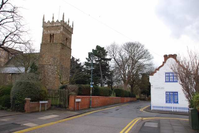
Photo: Allan chapman, CC BY-SA 2.0.
Old Clee is located in the Clee Road and Carr Lane area of eastern Grimsby, North East Lincolnshire, England, and adjoins the neighbouring town of Cleethorpes, to which it has historic links.
Cleethorpes

Photo: Jpacarter, CC BY-SA 3.0.
Cleethorpes is a seaside resort on the Lincolnshire coast of England, south bank of the estuary of the River Humber, with a population in 2021 of 30,000.
The Salvation Army (Hostal)
- Type: Building
- Address: 1-3 Eleanor Street, Grimsby, DN32 9DT
- Location: Bradley, North East Lincolnshire, England, United Kingdom, Britain and Ireland, Europe
- View on OpenStreetMap
Latitude
53.56729° or 53° 34′ 2″ northLongitude
-0.07438° or 0° 4′ 28″ westOpen location code
9C5XHW8G+W6OpenStreetMap ID
way 1020349280OpenStreetMap feature
building=yes
This page is based on OpenStreetMap, Wikidata, and Wikimedia Commons.
We’d love your help improving our open data sources. Thank you for contributing.
Satellite Map
Discover The Salvation Army (Hostal) from above in high-definition satellite imagery.
Notable Places Nearby
Highlights include Samurai Hearts Martial Arts Academy and Ash’s Darts Academy.
Nearby Places
Explore places such as Hancock’s Menswear and Art College.
England: Must-Visit Destinations
Delve into London, Manchester, Sheffield, and Leeds.
Curious Buildings to Discover
Uncover intriguing buildings from every corner of the globe.
About Mapcarta. Data © OpenStreetMap contributors and available under the Open Database License". Text is available under the CC BY-SA 4.0 license, except for photos, directions, and the map. Photo: sidibousaid, CC BY 2.0.