Sint-Michaëlschool
Sint-Michaëlschool is a building in Maastricht, South Limburg, Limburg. Sint-Michaëlschool is situated nearby to Heilig Hart, as well as near the cemetery De Beente.| Tap on a place to explore it |
Places of Interest Nearby
Highlights include Bonnefantenmuseum and Huis de Torentjes.
Bonnefantenmuseum
Museum
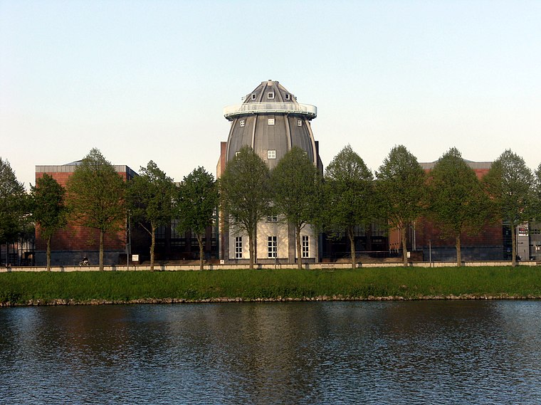
Photo: Mark Ahsmann, CC BY-SA 3.0.
The Bonnefanten Museum is a museum of historic, modern and contemporary art in Maastricht, Netherlands. Bonnefantenmuseum is situated 1½ km north of Sint-Michaëlschool.
Huis de Torentjes
Castle
 Huis de Torentjes is a castle, which is situated 730 metres west of Sint-Michaëlschool.
Hoogenweerth Castle
Castle

Photo: Pivos, CC BY-SA 3.0.
Hoogenweerth Castle is situated 1 km south of Sint-Michaëlschool.
Places in the Area
Nearby places include Villapark and Heer.
Villapark
Neighborhood
Villapark is a neighbourhood of Maastricht, Netherlands, located in the city's southwestern part. It is a relatively affluent neighbourhood.
Heer
Neighborhood
Heer is a neighbourhood of Maastricht, in the Dutch province of Limburg. Heer is a former municipality and village, incorporated into Maastricht in 1970 and, until 1828, this municipality was called "Heer en Keer".
Sint-Michaëlschool
- Type: Building
- Location: Maastricht, South Limburg, Limburg, Southern Netherlands, Netherlands, Benelux, Europe
- View on OpenStreetMap
Latitude
50.82975° or 50° 49′ 47″ northLongitude
5.70404° or 5° 42′ 15″ eastOpen location code
9F27RPH3+VJOpenStreetMap ID
way 1025460058OpenStreetMap feature
building=yes
This page is based on OpenStreetMap, Wikidata, and Wikimedia Commons.
We’d love your help improving our open data sources. Thank you for contributing.
Satellite Map
Discover Sint-Michaëlschool from above in high-definition satellite imagery.
Notable Places Nearby
Highlights include Michaël and Heilig Hart.
Nearby Places
Explore places such as Heugemerstraat/Wardehof and OK Maastricht Hoge Weerd.
South Limburg: Must-Visit Destinations
Delve into Heerlen, Kerkrade, Valkenburg aan de Geul, and Vaals.
Curious Buildings to Discover
Uncover intriguing buildings from every corner of the globe.
About Mapcarta. Data © OpenStreetMap contributors and available under the Open Database License". Text is available under the CC BY-SA 4.0 license, except for photos, directions, and the map. Photo: Bodoklecksel, CC BY-SA 3.0.