Auntie Sarah’s
Auntie Sarah’s is a fast food restaurant in Adur District, West Sussex, England. Auntie Sarah’s is situated nearby to the arts center Ropetackle Arts Centre, as well as near the art gallery West Street Loft Studios.| Tap on a place to explore it |
Places of Interest Nearby
Highlights include Marlipins Museum and St Peter’s Church, Shoreham-by-Sea.
Marlipins Museum
Museum

Photo: Michael Coppins, CC BY-SA 4.0.
Marlipins Museum, is a 12th to early-13th-century Grade II* listed building on the High Street in Shoreham-by-Sea, a town in Adur district in West Sussex, England. Marlipins Museum is situated 480 feet east of Auntie Sarah’s.
St Peter’s Church, Shoreham-by-Sea
Church

Photo: The Voice of Hassocks, Public domain.
The name St Peter's Church has been borne by two Roman Catholic churches in the town of Shoreham-by-Sea in the district of Adur, in the English county of West Sussex. St Peter’s Church, Shoreham-by-Sea is situated 620 feet north of Auntie Sarah’s.
Shoreham-by-Sea railway station
Railway station
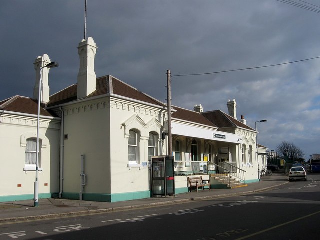
Photo: Simon Carey, CC BY-SA 2.0.
Shoreham-by-Sea railway station serves the town of Shoreham-by-Sea in the county of West Sussex, and also serves the nearby Shoreham Airport. The station and the majority of trains serving it are operated by Govia Thameslink Railway under its Southern brand. Shoreham-by-Sea railway station is situated 1,700 feet northeast of Auntie Sarah’s.
Places in the Area
Nearby places include Shoreham-by-Sea and Kingston by Sea.
Shoreham-by-Sea

Photo: Acabashi, CC BY-SA 4.0.
Shoreham-by-Sea is a town in West Sussex, England between Worthing and Brighton. It is the seat of Adur District which includes the parishes of Coombes, Lancing and Sompting.
Kingston by Sea
Village

Photo: Simon Carey, CC BY-SA 2.0.
Kingston by Sea, also known as Kingston Buci, Kingston Bucii or simply Kingston, is a small area in the Adur district of West Sussex, England. Although it is now part of a continuous urban area, its origins lay in an ancient village and parish church between…
Southwick
Town

Photo: The Voice of Hassocks, Public domain.
Southwick is a town in the Adur district of West Sussex, England located five miles west of Brighton. It covers an area of 863.7 ha. In 2001 it had a population of 13,195. Southwick is situated 1½ miles east of Auntie Sarah’s.
Auntie Sarah’s
- Type: Fast food restaurant
- Cuisine: sandwich
- Categories: building, food, and restaurant
- Location: Adur District, West Sussex, South East England, England, United Kingdom, Britain and Ireland, Europe
- View on OpenStreetMap
Latitude
50.83254° or 50° 49′ 57″ northLongitude
-0.27803° or 0° 16′ 41″ westOpen location code
9C2XRPMC+2QOpenStreetMap ID
way 1029018112OpenStreetMap feature
amenity=fast_foodOpenStreetMap feature
building=yesOpenStreetMap attribute
cuisine=sandwich
This page is based on OpenStreetMap, Wikidata, and Wikimedia Commons.
We’d love your help improving our open data sources. Thank you for contributing.
Satellite Map
Discover Auntie Sarah’s from above in high-definition satellite imagery.
Notable Places Nearby
Highlights include West Street Loft Studios and Ropetackle Arts Centre.
Nearby Places
Explore places such as The Scanning Room and First Foot Clinic.
West Sussex: Must-Visit Destinations
Delve into Chichester, Crawley, Worthing, and Horsham.
Curious Fast Food Restaurants to Discover
Uncover intriguing fast food restaurants from every corner of the globe.
About Mapcarta. Data © OpenStreetMap contributors and available under the Open Database License". Text is available under the CC BY-SA 4.0 license, except for photos, directions, and the map. Photo: wildlife encounters, CC BY 2.0.