Fizine - Roman port and fish farm
Fizine - Roman port and fish farm is an archaeological site in Piran, Coast and Karst. Fizine - Roman port and fish farm is situated nearby to the pier Pomol pomorske šole za usposabljanje z rešilnimi čolni, as well as near the marina GEPŠ in FPP.| Tap on a place to explore it |
Places of Interest Nearby
Highlights include Tartini Square and Sergej Mašera Maritime Museum Piran.
Tartini Square
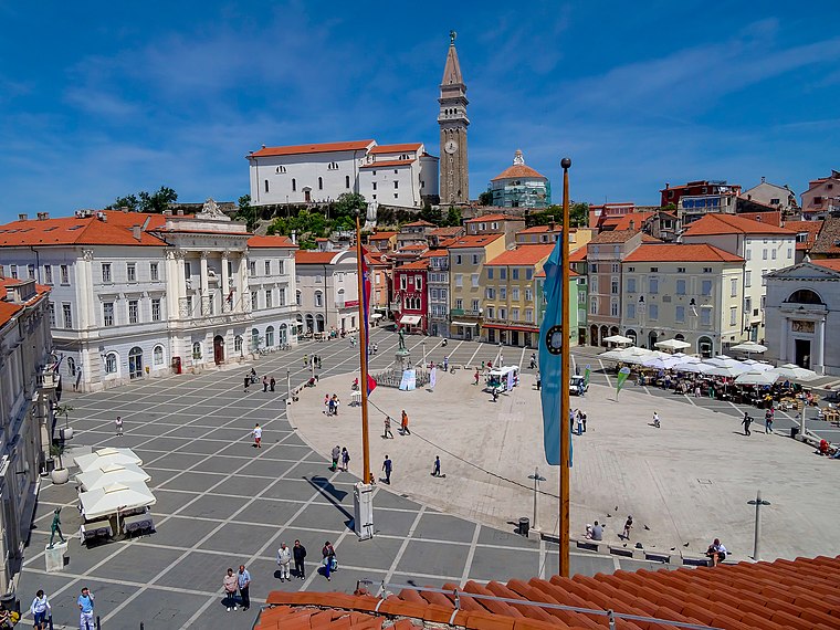
Photo: Grega Pirc, CC BY 3.0.
Tartini Square is the largest and main town square in Piran, Slovenia. It was named after violinist and composer Giuseppe Tartini, of whom a monument was made in 1896. Tartini Square is situated 1½ km northwest of Fizine - Roman port and fish farm.
Sergej Mašera Maritime Museum Piran
Museum
 Sergej Mašera Maritime Museum Piran is situated 1½ km northwest of Fizine - Roman port and fish farm.
Town wall

Photo: Zlerman, CC BY-SA 3.0.
The Walls of Piran are the defensive walls of Piran, a coastal town on the Adriatic Sea in southwestern Slovenia. Significant parts of the fortification walls remain well-preserved. Town wall is situated 1½ km north of Fizine - Roman port and fish farm.
Places in the Area
Nearby places include Portorož and Pacug.
Portorož

Photo: Grant Bishop, CC BY-SA 2.0.
Portorož is a Slovenian Adriatic seaside resort and spa settlement located in the Municipality of Piran in southwestern Slovenia. Its modern development began in the late 19th century with the vogue for the first health resorts.

Lucija
Suburb

Photo: Shabicht, CC BY-SA 4.0.
Lucija is a settlement in the Municipality of Piran in the Slovene Istria region. With a population over 6,000, it is the largest settlement in Slovenia that is not a municipality in its own right.
Fizine - Roman port and fish farm
- Type: Archaeological site
- Also known as: “Fizine - rimsko pristanišče in ribogojnica”
- Categories: historic site, tourist attraction, and tourism
- Location: Piran, Coast and Karst, Slovenia, Central Europe, Europe
- View on OpenStreetMap
Latitude
45.51514° or 45° 30′ 55″ northLongitude
13.57892° or 13° 34′ 44″ eastOpen location code
8FQMGH8H+3HOpenStreetMap ID
way 1029555872OpenStreetMap feature
historic=archaeological_site
This page is based on OpenStreetMap, Wikidata, and Wikimedia Commons.
We’d love your help improving our open data sources. Thank you for contributing.
Satellite Map
Discover Fizine - Roman port and fish farm from above in high-definition satellite imagery.
Notable Places Nearby
Highlights include Pomol pomorske šole za usposabljanje z rešilnimi čolni and GEPŠ in FPP.
Nearby Places
Explore places such as Fizine and Mercator.
Coast and Karst: Must-Visit Destinations
Delve into Koper, Nova Gorica, Postojna, and Izola.
Curious Archaeological Sites to Discover
Uncover intriguing archaeological sites from every corner of the globe.
About Mapcarta. Data © OpenStreetMap contributors and available under the Open Database License". Text is available under the CC BY-SA 4.0 license, except for photos, directions, and the map. Photo: Dimitry Anikin, CC BY 2.0.