Ruxley Gravel Pits
Ruxley Gravel Pits is a nature reserve in Bromley, Greater London, England. Ruxley Gravel Pits is situated nearby to the locality Crittall’s Corner, as well as near the suburb St Paul’s Cray.| Tap on a place to explore it |
Places of Interest
Highlights include St Mary Cray railway station and Queen Mary’s Hospital.
St Mary Cray railway station
Railway station

Photo: Sunil060902, CC BY-SA 3.0.
St Mary Cray railway station is in St Mary Cray, South East London within the London Borough of Bromley. It is 14 miles 57 chains down the line from London Victoria.
Queen Mary’s Hospital
Hospital

Photo: Dr Neil Clifton, CC BY-SA 2.0.
Queen Mary's Hospital is an acute district general hospital in Sidcup, South East London, serving the population of the London Borough of Bexley. It was previously administered by Queen Mary's Sidcup NHS Trust, established in 1993.
Foots Cray Meadows
Park

Photo: Ethan Doyle White, CC BY-SA 4.0.
Foots Cray Meadows is an area of parkland and woodland 97 hectares in size, within the London Borough of Bexley, England. It borders the suburbs of Albany Park, Sidcup, Foots Cray, North Cray and Ruxley.
Places in the Area
Nearby places include Greenwich and Bexley.
Greenwich
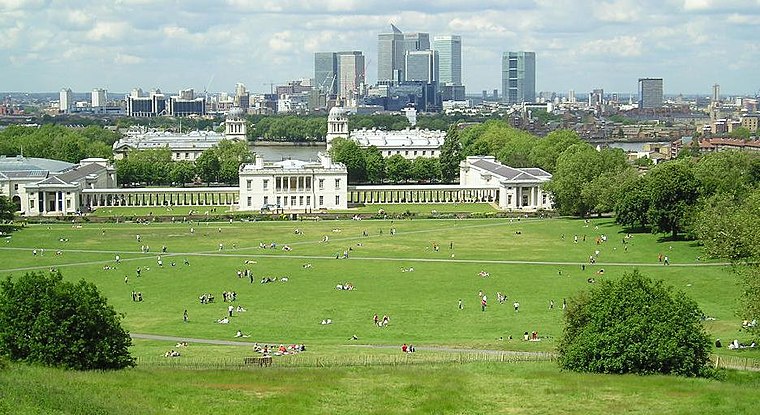
Photo: Sebjarod, Public domain.
Greenwich is a famous maritime district of south east London - 5.5 miles from central London. An area of great historical importance, the town centre contains Maritime Greenwich - one of London's four UNESCO World Heritage sites - known for its naval history, connections with the Royal Family and as the location from which the Prime Meridian is derived.
Bexley
Suburb

Photo: P Ingerson, Public domain.
Bexley is an area of south-eastern Greater London, England and part of the London Borough of Bexley. It is sometimes known as Bexley Village or Old Bexley to differentiate the area from the wider borough.
Chislehurst
Suburb

Photo: Ian Capper, CC BY-SA 2.0.
Chislehurst is a suburban district of south-east London, England, in the London Borough of Bromley. It lies east of Bromley, south-west of Sidcup and north-west of Orpington, 10 miles south-east of Charing Cross.
Ruxley Gravel Pits
- Type: Nature reserve
- Category: recreation area
- Location: Bromley, Greater London, England, United Kingdom, Britain and Ireland, Europe
- View on OpenStreetMap
Latitude
51.41° or 51° 24′ 36″ northLongitude
0.1167° or 0° 7′ 0″ eastOpen location code
9F32C458+XMOpenStreetMap ID
way 1034607024OpenStreetMap feature
leisure=nature_reserve
This page is based on OpenStreetMap, Wikidata, and Wikimedia Commons.
We’d love your help improving our open data sources. Thank you for contributing.
Satellite Map
Discover Ruxley Gravel Pits from above in high-definition satellite imagery.
Localities in the Area
Explore places such as Crittall’s Corner and St Paul’s Cray.
Notable Places Nearby
Highlights include New Barge Lake and Big Lake.
England: Must-Visit Destinations
Delve into London, Manchester, Sheffield, and Leeds.
Curious Nature Reserves to Discover
Uncover intriguing nature reserves from every corner of the globe.
About Mapcarta. Data © OpenStreetMap contributors and available under the Open Database License". Text is available under the CC BY-SA 4.0 license, except for photos, directions, and the map. Photo: Mario modesto, CC BY-SA 3.0.