Capela de São Brás
Capela de São Brás is a church in Perafita, Lavra e Santa Cruz do Bispo, Matosinhos, Porto District. Capela de São Brás is situated nearby to the church Capela de São Sebastião, as well as near the power station Central de Valorização Energética do Biogás de Matosinhos.| Tap on a place to explore it |
Places of Interest Nearby
Highlights include Esposade metro station and Ponte do Carro.
Esposade metro station
Railway station
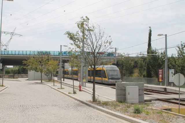
Photo: Ernstkers, CC BY-SA 4.0.
Esposade metro station is a railway station, which is situated 700 metres southeast of Capela de São Brás.
Ponte do Carro
Bridge
 Ponte do Carro is a bridge, which is situated 580 metres southwest of Capela de São Brás.
Crestins metro station
Railway station

Photo: Ernstkers, CC BY-SA 4.0.
Crestins metro station is a railway station, which is situated 1½ km north of Capela de São Brás.
Places in the Area
Nearby places include Custóias and Pedras Rubras.
Custóias
Town
Custóias is a former civil parish in the municipality of Matosinhos in the Greater Porto area, Portugal. In 2013, the parish merged into the new parish Custóias, Leça do Balio e Guifões.
Pedras Rubras
Neighborhood
Pedras Rubras is a Portuguese locality and suburb in the Moreira parish, in the Maia Municipality of the Greater Porto subregion. The Porto Airport terminal and part of runway is located in Pedras Rubras. Pedras Rubras is situated 3 km north of Capela de São Brás.
Perafita
Town
Perafita, Lavra e Santa Cruz do Bispo is a civil parish in the municipality of Matosinhos, Portugal. It was formed in 2013 by the merger of the former parishes Perafita, Lavra and Santa Cruz do Bispo. Perafita is situated 3 km west of Capela de São Brás.
Capela de São Brás
- Type: Church
- Also known as: “Capela de Nossa Senhora do Livramento”
- Categories: building, chapel, place of worship, and religion
- Location: Perafita, Lavra e Santa Cruz do Bispo, Matosinhos, Porto District, Portugal, Iberia, Europe
- View on OpenStreetMap
Latitude
41.21872° or 41° 13′ 7″ northLongitude
-8.66216° or 8° 39′ 44″ westOpen location code
8CHH689Q+F4OpenStreetMap ID
way 1035994977OpenStreetMap feature
amenity=place_of_worshipOpenStreetMap feature
building=chapel
This page is based on OpenStreetMap, Wikidata, and Wikimedia Commons.
We’d love your help improving our open data sources. Thank you for contributing.
Satellite Map
Discover Capela de São Brás from above in high-definition satellite imagery.
Places with the Same Name
Discover other places named “Capela de São Brás”.
Notable Places Nearby
Highlights include Capela de São Sebastião and Central de Valorização Energética do Biogás de Matosinhos.
Nearby Places
Explore places such as Monte São Brás and Parque Natural do Monte de São Brás.
Portugal: Must-Visit Destinations
Delve into Lisbon, Caldas da Rainha, Porto, and Coimbra.
Curious Churches to Discover
Uncover intriguing churches from every corner of the globe.
About Mapcarta. Data © OpenStreetMap contributors and available under the Open Database License". Text is available under the CC BY-SA 4.0 license, except for photos, directions, and the map. Photo: Vitor Oliveira, CC BY-SA 2.0.