Reeënberg - NM
Reeënberg - NM is a nature reserve in Apeldoorn Municipality, Gelderland. Reeënberg - NM is situated nearby to the locality Nationaal Ereveld Loenen, as well as near the neighborhood Zomeroord.| Tap on a place to explore it |
Places of Interest
Highlights include Station Loenen and Veluwsche Stoomtrein Maatschappij.
Station Loenen
Railway station
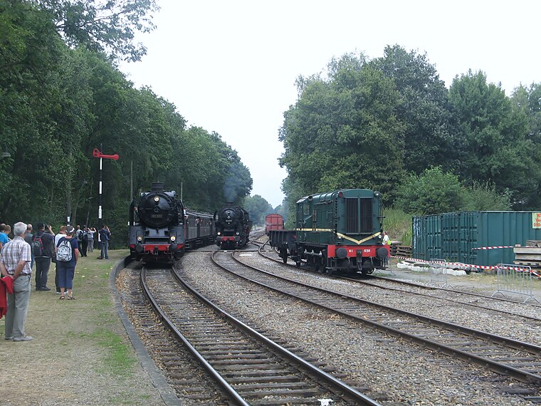
Photo: CrabbyPatrick, CC BY 3.0.
Station Loenen is a railway station.
Veluwsche Stoomtrein Maatschappij
Museum

Photo: Rob Dammers, CC BY 2.0.
Veluwse Stoomtrein Maatschappij is a Dutch heritage railway between Apeldoorn and Dieren. It passes through the villages of Lieren/Beekbergen, Loenen, and Eerbeek.
Beekbergen train station
Railway station

Photo: T Houdijk, CC BY-SA 3.0.
Beekbergen train station is a railway station.
Places in the Area
Nearby places include Beekbergen and Loenen.
Beekbergen
Village
 Beekbergen is a village and former municipality in the Dutch province of Gelderland. It is located in the municipality of Apeldoorn on the edge of the Veluwe.
Loenen
Village

Photo: Wikimedia, CC BY-SA 4.0.
Loenen is a village in the Dutch province of Gelderland. It is located in the municipality of Apeldoorn, about 10 km southeast of that city. Loenen was a separate municipality until 1818, when it was merged with Apeldoorn.
Lieren
Village

Photo: Koosg, CC BY-SA 3.0.
Lieren is a village in the Netherlands and part of the municipality of Apeldoorn. It is situated about 8 km south-east of the city centre of Apeldoorn and 2 km east of Beekbergen.
Reeënberg - NM
- Type: Nature reserve
- Category: recreation area
- Location: Apeldoorn Municipality, Gelderland, Eastern Netherlands, Netherlands, Benelux, Europe
- View on OpenStreetMap
Latitude
52.1305° or 52° 7′ 50″ northLongitude
5.9913° or 5° 59′ 29″ eastOperator
NatuurmonumentenOpen location code
9F474XJR+5GOpenStreetMap ID
way 1036371786OpenStreetMap feature
leisure=nature_reserve
This page is based on OpenStreetMap, Wikidata, and Wikimedia Commons.
We’d love your help improving our open data sources. Thank you for contributing.
Satellite Map
Discover Reeënberg - NM from above in high-definition satellite imagery.
Localities in the Area
Explore places such as Nationaal Ereveld Loenen and Zomeroord.
Notable Places Nearby
Highlights include De Reeënberg and Reeënberg.
Gelderland: Must-Visit Destinations
Delve into Arnhem, Nijmegen, Ede, and Zutphen.
Curious Nature Reserves to Discover
Uncover intriguing nature reserves from every corner of the globe.
About Mapcarta. Data © OpenStreetMap contributors and available under the Open Database License". Text is available under the CC BY-SA 4.0 license, except for photos, directions, and the map. Photo: Agnes Monkelbaan, CC BY-SA 4.0.