ex Municipio di Soleto
ex Municipio di Soleto is a building in Soleto, Lecce, Apulia. ex Municipio di Soleto is situated nearby to the church Chiesa delle Abine e del Santissimo Rosario, as well as near San Nicola.| Tap on a place to explore it |
Places of Interest Nearby
Highlights include Maria Santissima Assunta and Raimondello Tower (Soleto, Italy).
Maria Santissima Assunta
Church

Photo: Lupiae, CC BY-SA 3.0.
Maria Santissima Assunta is a church, which is situated 190 metres southwest of ex Municipio di Soleto.
Raimondello Tower (Soleto, Italy)
Monument
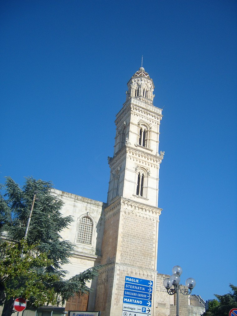
Photo: Freddyballo, CC BY-SA 3.0.
Raimondello Tower (Soleto, Italy) is a monument, which is situated 200 metres southwest of ex Municipio di Soleto.
Zollino railway station
Railway station

Photo: philstephenrichards, CC BY-SA 2.0.
Zollino is a railway station in Zollino, Italy. The station is located on the Lecce–Otranto railway and Zollino-Gallipoli railway. The train services and the railway infrastructure are operated by Ferrovie del Sud Est. Zollino railway station is situated 3 km northeast of ex Municipio di Soleto.
Places in the Area
Nearby places include Galatina and Galugnano.
Galatina
Town

Photo: Lupiae, CC BY-SA 3.0.
Galatina, known before the unification of Italy as San Pietro in Galatina, is a town and comune in the Province of Lecce in Apulia, southern Italy. It is situated about 21 kilometres south of the city of Lecce. Galatina is situated 3½ km southwest of ex Municipio di Soleto.
Galugnano
Village
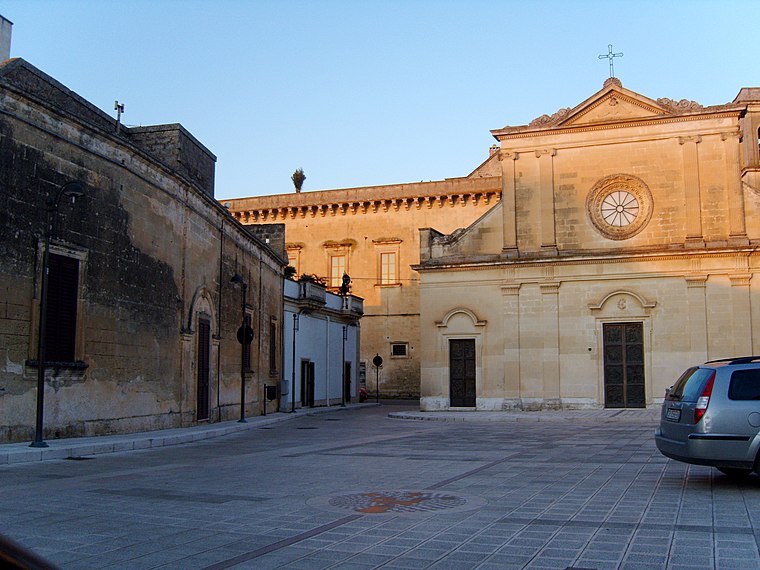
Photo: Freddyballo, CC BY-SA 3.0.
Galugnano is a village, which is situated 8 km north of ex Municipio di Soleto.
ex Municipio di Soleto
- Type: Building
- Also known as: “Comune di Soleto”
- Location: Soleto, Lecce, Apulia, Southern Italy, Italy, Europe
- View on OpenStreetMap
Latitude
40.18777° or 40° 11′ 16″ northLongitude
18.20742° or 18° 12′ 27″ eastOpen location code
8FGW56Q4+4XOpenStreetMap ID
way 1036865588OpenStreetMap feature
building=yes
This page is based on OpenStreetMap, Wikidata, and Wikimedia Commons.
We’d love your help improving our open data sources. Thank you for contributing.
Satellite Map
Discover ex Municipio di Soleto from above in high-definition satellite imagery.
Notable Places Nearby
Highlights include Chiesa delle Abine e del Santissimo Rosario and San Nicola.
Nearby Places
Explore places such as Niceta and Pasticceria Simon.
Lecce: Must-Visit Destinations
Delve into Lecce, Otranto, Gallipoli, and Nardò.
Curious Buildings to Discover
Uncover intriguing buildings from every corner of the globe.
About Mapcarta. Data © OpenStreetMap contributors and available under the Open Database License". Text is available under the CC BY-SA 4.0 license, except for photos, directions, and the map. Photo: Wikimedia, CC0.