Molchstation Traiskirchen
Molchstation Traiskirchen is in Traiskirchen, Politischer Bezirk Baden, Lower Austria. Molchstation Traiskirchen is situated nearby to the shopping center EKZ-Traiskirchen Nord, as well as near the fountain Europaplatz.| Tap on a place to explore it |
Places of Interest Nearby
Highlights include Traiskirchen Aspangbahn railway station and St. Margareta (Traiskirchen).
Traiskirchen Aspangbahn railway station
Railway station

Photo: Priwo, Public domain.
Traiskirchen Aspangbahn railway station is situated 570 metres southeast of Molchstation Traiskirchen.
St. Margareta (Traiskirchen)
Church
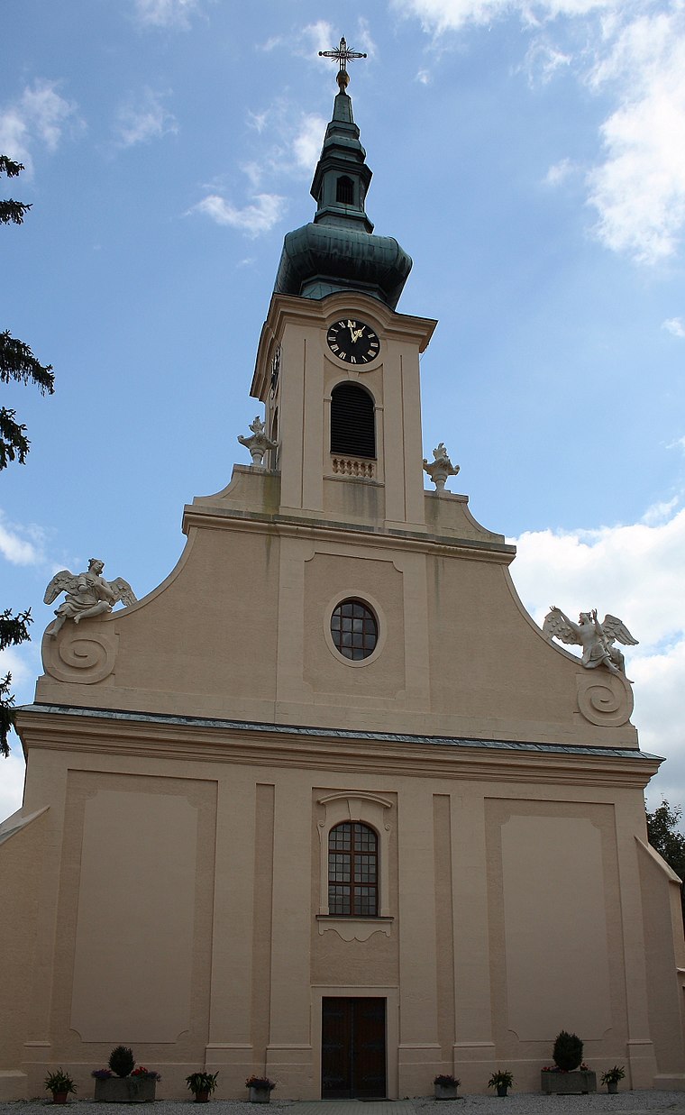
Photo: Bwag, CC BY-SA 3.0.
St. Margareta (Traiskirchen) is a church, which is situated 500 metres southwest of Molchstation Traiskirchen.
Stadtmuseum Traiskirchen
Museum

Photo: Bwag, CC BY-SA 3.0.
Stadtmuseum Traiskirchen is situated 1¼ km northeast of Molchstation Traiskirchen.
Places in the Area
Nearby places include Pfaffstätten and Tribuswinkel.
Pfaffstätten
Village

Photo: Wikimedia, CC BY-SA 3.0.
Pfaffstätten is a town in the district of Baden in Lower Austria in Austria. Pfaffstätten is situated 2½ km west of Molchstation Traiskirchen.
Tribuswinkel
Village

Photo: Bwag, CC BY-SA 4.0.
Tribuswinkel is a town and cadastral community in the district of Baden in Lower Austria in northeast Austria. Since 1972, it is part of the Municipality of Traiskirchen. Tribuswinkel is situated 2½ km southwest of Molchstation Traiskirchen.
Gumpoldskirchen
Village

Photo: Bwag, CC BY-SA 4.0.
Gumpoldskirchen is a town in the district of Mödling in the Austrian state of Lower Austria. Gumpoldskirchen borders on the municipalities Mödling, Guntramsdorf, Gaaden, Pfaffstätten and Traiskirchen. Gumpoldskirchen is situated 3 km northwest of Molchstation Traiskirchen.
Molchstation Traiskirchen
- Type: Industry
- Location: Traiskirchen, Politischer Bezirk Baden, Lower Austria, Austria, Central Europe, Europe
- View on OpenStreetMap
Latitude
48.02165° or 48° 1′ 18″ northLongitude
16.29816° or 16° 17′ 53″ eastOperator
Gas Connect AustriaOpen location code
8FWR27CX+M7OpenStreetMap ID
way 1037085730OpenStreetMap feature
landuse=industrial
This page is based on OpenStreetMap, Wikidata, and Wikimedia Commons.
We’d love your help improving our open data sources. Thank you for contributing.
Satellite Map
Discover Molchstation Traiskirchen from above in high-definition satellite imagery.
Notable Places Nearby
Highlights include EKZ-Traiskirchen Nord and Europaplatz.
Nearby Places
Explore places such as ARBÖ Traiskirchen and BP.
Lower Austria: Must-Visit Destinations
Delve into St. Pölten, Wiener Neustadt, Amstetten, and Klosterneuburg.
Curious Places to Discover
Uncover intriguing places from every corner of the globe.
About Mapcarta. Data © OpenStreetMap contributors and available under the Open Database License". Text is available under the CC BY-SA 4.0 license, except for photos, directions, and the map. Photo: Lonezor, CC BY-SA 3.0.