CAPS 16 Rafael Calzada
CAPS 16 Rafael Calzada is a clinic in Almirante Brown Partido, Buenos Aires which is located on Avenida General San Martín. CAPS 16 Rafael Calzada is situated nearby to the park Plaza, as well as near the community center Sociedad de Fomento ‘17 de Agosto’.| Tap on a place to explore it |
- Email: calzada.saludbrown@gmail.com
- Type: Clinic
- Address: 4900 Avenida General San Martín, Rafael Calzada, B1847
Places of Interest Nearby
Highlights include Claypole train station and Rafael Calzada train station.
Claypole train station
Railway station
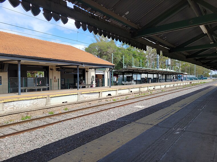
Photo: Hurfer, CC BY-SA 4.0.
Claypole train station is a railway station, which is situated 2 km south of CAPS 16 Rafael Calzada.
Rafael Calzada train station
Railway station
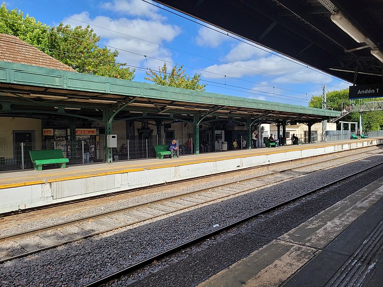
Photo: Hurfer, CC BY-SA 4.0.
Rafael Calzada train station is a railway station, which is situated 2½ km southwest of CAPS 16 Rafael Calzada.
Barrio Don Orione
Residential area

Photo: Oxigeno777, CC BY-SA 4.0.
Barrio Don Orione is a residential area, which is situated 4 km south of CAPS 16 Rafael Calzada.
Places in the Area
Nearby places include Rafael Calzada and Claypole.
Rafael Calzada
Town

Photo: Ulises Icardi, CC BY-SA 4.0.
Rafael Calzada is an Argentine city within the Almirante Brown Partido, which is located in the Greater Buenos Aires conurbation, Argentina. It has an area of 5.14 km2 and a population of 56,419.
Claypole
Town

Photo: Alpertron, CC BY-SA 3.0.
Claypole is an Argentine city located in the southern part of the Almirante Brown Partido, Buenos Aires Province with a population of 41,176. Claypole is situated 2½ km south of CAPS 16 Rafael Calzada.
San Francisco Solano
Town

Photo: gustavochavez, CC BY 3.0.
San Francisco Solano, usually known as Solano, is a city in Buenos Aires Province, Argentina. It forms part of the Greater Buenos Aires agglomeration. It is divided between the Quilmes and Almirante Brown partidos. San Francisco Solano is situated 3 km east of CAPS 16 Rafael Calzada.
CAPS 16 Rafael Calzada
- Categories: health care and building
- Location: Almirante Brown Partido, Buenos Aires, Pampas, Argentina, South America
- View on OpenStreetMap
Latitude
-34.78146° or 34° 46′ 53″ southLongitude
-58.33795° or 58° 20′ 17″ westOperator
MunicipalOpen location code
48Q36M96+CROpenStreetMap ID
way 1038831423OpenStreetMap feature
amenity=clinicOpenStreetMap feature
building=yesOpenStreetMap feature
healthcare=clinic
This page is based on OpenStreetMap, Wikidata, and Wikimedia Commons.
We’d love your help improving our open data sources. Thank you for contributing.
Satellite Map
Discover CAPS 16 Rafael Calzada from above in high-definition satellite imagery.
Notable Places Nearby
Highlights include Plaza and Sociedad de Fomento ‘17 de Agosto’.
Nearby Places
Explore places such as Kiosco Selah and Demoliciones Gallo.
Buenos Aires: Must-Visit Destinations
Delve into Buenos Aires, La Plata, Mar del Plata, and Centro.
Curious Clinics to Discover
Uncover intriguing clinics from every corner of the globe.
About Mapcarta. Data © OpenStreetMap contributors and available under the Open Database License". Text is available under the CC BY-SA 4.0 license, except for photos, directions, and the map. Photo: Mbusin, CC BY-SA 4.0.