Netherhall Way
Netherhall Way is an electrical substation in Cambridge District, Cambridgeshire, England. Netherhall Way is situated nearby to Netherhall School, as well as near Queen Edith Primary School.| Tap on a place to explore it |
Places of Interest Nearby
Highlights include West Pit and Netherhall School.
West Pit
Nature reserve

Photo: Dudley Miles, CC BY-SA 4.0.
West Pit is a 4.3 hectare Local Nature Reserve in Cherry Hinton, on the south-eastern outskirts of Cambridge. It is part of the Cherry Hinton Pit biological Site of Special Scientific Interest, which includes the neighbouring East Pit.
Netherhall School
School

Photo: John Sutton, CC BY-SA 2.0.
The Netherhall School and The Oakes College is a mixed secondary school and sixth form located in the Queen Edith ward of Cambridge, England. Its logo is a modified version of the arms of the City of Cambridge. Netherhall School is situated 1,000 feet east of Netherhall Way.
St James
Church

Photo: Smb1001, CC BY-SA 4.0.
St James is a church, which is situated 2,200 feet northwest of Netherhall Way.
Places in the Area
Nearby places include Cherry Hinton and Gog Magog Hills.
Cherry Hinton
Suburb
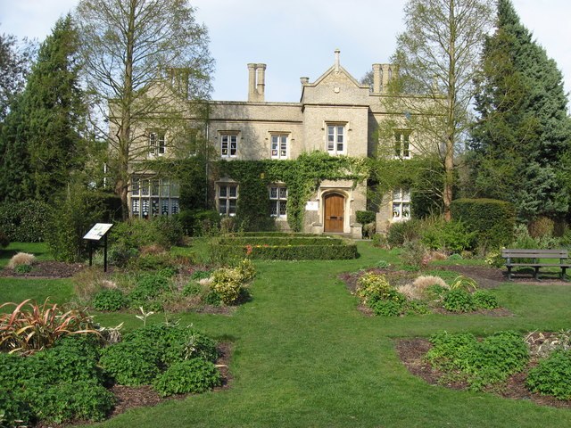
Photo: Pete Saunders, CC BY-SA 2.0.
Cherry Hinton is a village and electoral ward in Cambridge, England. As of the 2021 UK census, the ward's population was 9,343 people.
Gog Magog Hills
Locality
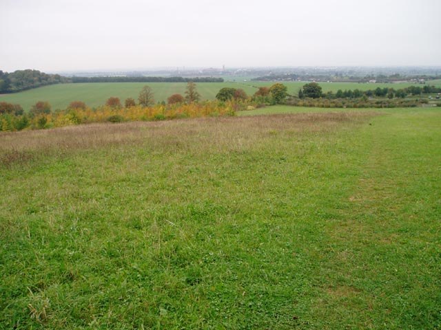
Photo: David Gruar, CC BY-SA 2.0.
The Gog Magog Hills are a range of low chalk hills extending for several miles to the southeast of Cambridge in England. The highest points are either side of the A1307 Babraham Road, and are marked on Ordnance Survey 1:25000 maps as Little Trees Hill and Wandlebury Hill, at 74 m, and Telegraph Clump, at 75 m.
Highsett
Neighborhood

Photo: Dr Julian Paren, CC BY-SA 2.0.
Highsett is a residential estate and a listed heritage site in Cambridge, England. The estate was designed by Eric Lyons of Eric Lyons & Partners. It was built in three phases between 1959 and 1964. Highsett is situated 1½ miles northwest of Netherhall Way.
Netherhall Way
- Type: Electrical substation
- Category: industry
- Location: Cambridge District, Cambridgeshire, England, United Kingdom, Britain and Ireland, Europe
- View on OpenStreetMap
Latitude
52.1781° or 52° 10′ 41″ northLongitude
0.15989° or 0° 9′ 36″ eastOperator
UK Power NetworksOpen location code
9F4255H5+6XOpenStreetMap ID
way 1040558823
This page is based on OpenStreetMap, Wikidata, and Wikimedia Commons.
We’d love your help improving our open data sources. Thank you for contributing.
Satellite Map
Discover Netherhall Way from above in high-definition satellite imagery.
Notable Places Nearby
Highlights include Queen Edith Primary School and West Pit.
Nearby Places
Explore places such as Strangeways Road and Almoners Ave.
England: Must-Visit Destinations
Delve into London, Manchester, Sheffield, and Leeds.
Curious Electrical Substations to Discover
Uncover intriguing electrical substations from every corner of the globe.
About Mapcarta. Data © OpenStreetMap contributors and available under the Open Database License". Text is available under the CC BY-SA 4.0 license, except for photos, directions, and the map. Photo: sidibousaid, CC BY 2.0.