Aridac
Aridac is an industrial building in Canovelles, Barcelona, Catalonia. Aridac is situated nearby to the house Can Poldo, as well as near the school Escola Jacint Verdaguer.| Tap on a place to explore it |
Places of Interest Nearby
Highlights include Sant Feliu de Canovelles and Can Colomer.
Sant Feliu de Canovelles
Church

Photo: amadalvarez, CC BY 2.5.
Sant Feliu de Canovelles is a church, which is situated 570 metres southwest of Aridac.
Can Colomer
Ruins

Photo: Amadalvarez, CC BY-SA 4.0.
Can Colomer is a ruins, which is situated 640 metres west of Aridac.
Les Franqueses del Vallès station
Railway station
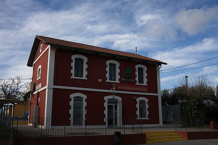
Photo: Amadalvarez, CC BY-SA 4.0.
Les Franqueses del Vallès station is a railway station, which is situated 1 km east of Aridac.
Places in the Area
Nearby places include La Barriada Nova and Corró d’Avall.


Aridac
- Type: Industrial building
- Categories: building and industry
- Location: Canovelles, Barcelona, Catalonia, Eastern Spain, Spain, Iberia, Europe
- View on OpenStreetMap
Latitude
41.62853° or 41° 37′ 43″ northLongitude
2.28248° or 2° 16′ 57″ eastOpen location code
8FH4J7HJ+CXOpenStreetMap ID
way 1047649586OpenStreetMap feature
building=industrial
This page is based on OpenStreetMap, Wikidata, and Wikimedia Commons.
We’d love your help improving our open data sources. Thank you for contributing.
Satellite Map
Discover Aridac from above in high-definition satellite imagery.
Notable Places Nearby
Highlights include Can Poldo and Escola Jacint Verdaguer.
Nearby Places
Explore places such as Felmar and Sar Truck.
Barcelona: Must-Visit Destinations
Delve into Barcelona, Malgrat de Mar, Terrassa, and Badalona.
Curious Industrial Buildings to Discover
Uncover intriguing industrial buildings from every corner of the globe.
About Mapcarta. Data © OpenStreetMap contributors and available under the Open Database License". Text is available under the CC BY-SA 4.0 license, except for photos, directions, and the map. Photo: Alex Micheu Photography, CC BY-SA 3.0.