Carlisle Street East
Carlisle Street East is an electrical substation in Sheffield, England. Carlisle Street East is situated nearby to the historic site Siemens Gateway, as well as near Norroy Bridge.| Tap on a place to explore it |
Places of Interest Nearby
Highlights include Crucible Theatre and Sheffield Energy Recovery Facility.
Crucible Theatre
Theater building

Photo: Chris Downer, CC BY-SA 2.0.
The Crucible Theatre, or simply The Crucible, is a theatre in Sheffield, South Yorkshire, England, which opened in 1971. Its name refers to crucible steel, which was developed in Sheffield in 1740 and drove the industrialisation of the city. Crucible Theatre is situated 1¼ miles southwest of Carlisle Street East.
Sheffield Energy Recovery Facility
Power station
 The Sheffield Energy Recovery Facility, also known as the Energy from Waste Plant, is a modern incinerator which treats Sheffield's household waste. It is notable as it not only provides electricity from the combustion of waste but also supplies heat to a local district heating scheme, making it one of the most advanced, energy efficient incineration plants in the UK. Sheffield Energy Recovery Facility is situated 2,900 feet south of Carlisle Street East.
Sheffield Cathedral
Church
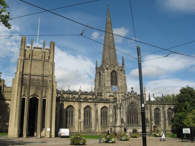
Photo: Richard Rogerson, CC BY-SA 2.0.
The Cathedral Church of St Peter and St Paul, Sheffield, also known as Sheffield Cathedral, is the cathedral church for the Church of England diocese of Sheffield, England. Sheffield Cathedral is situated 1¼ miles southwest of Carlisle Street East.
Places in the Area
Nearby places include Burngreave and Pitsmoor.
Burngreave
Suburb
Burngreave is an inner city district of Sheffield, South Yorkshire, England lying north of the city centre. The population of the ward taken at the 2011 census was 27,481.
Pitsmoor
Suburb

Photo: David Lally, CC BY-SA 2.0.
Pitsmoor is a former village, now a suburb of Sheffield, England. The name derives from Or-pits as, anciently, the main local industry was the mining of ore. The village falls within the Burngreave ward of the City.
Attercliffe
Suburb
Attercliffe is an industrial suburb of northeast Sheffield, England on the south bank of the River Don. The suburb falls in the Darnall ward of Sheffield City Council.
Carlisle Street East
- Type: Electrical substation
- Categories: building and industry
- Location: Sheffield, England, United Kingdom, Britain and Ireland, Europe
- View on OpenStreetMap
Latitude
53.39473° or 53° 23′ 41″ northLongitude
-1.44978° or 1° 26′ 59″ westOpen location code
9C5W9HV2+V3OpenStreetMap ID
way 1049410731OpenStreetMap feature
building=yes
This page is based on OpenStreetMap, Wikidata, and Wikimedia Commons.
We’d love your help improving our open data sources. Thank you for contributing.
Satellite Map
Discover Carlisle Street East from above in high-definition satellite imagery.
Notable Places Nearby
Highlights include Siemens Gateway and Norroy Bridge.
Nearby Places
Explore places such as Carlisle Street/Atlas Street and Carlisle Street/Sutherland Road.
England: Must-Visit Destinations
Delve into London, Manchester, Leeds, and York.
Curious Electrical Substations to Discover
Uncover intriguing electrical substations from every corner of the globe.
About Mapcarta. Data © OpenStreetMap contributors and available under the Open Database License". Text is available under the CC BY-SA 4.0 license, except for photos, directions, and the map. Photo: sidibousaid, CC BY 2.0.