Elms Lea Dentist
Elms Lea Dentist is a dental clinic in Brighton and Hove, England which is located on Elms Lea Avenue. Elms Lea Dentist is situated nearby to St Bernadette’s Catholic Primary School, as well as near the sports venue Train Station.| Tap on a place to explore it |
Places of Interest Nearby
Highlights include Preston Park railway station and St John the Evangelist’s Church, Preston Village.
Preston Park railway station
Railway station

Photo: Hassocks5489, Public domain.
Preston Park railway station is on the Brighton Main Line in England, serving Preston Village and the northern suburban areas of the city of Brighton and Hove, East Sussex. Preston Park railway station is situated 960 feet southwest of Elms Lea Dentist.
St John the Evangelist’s Church, Preston Village
Church

Photo: Hassocks5489, Public domain.
St John the Evangelist's Church is an Anglican church in the Preston Village area of Brighton, in the English city of Brighton and Hove. The Grade II listed building, designed by Sir Arthur Blomfield, was started in 1901 but did not take its present form for another quarter of a century. St John the Evangelist’s Church, Preston Village is situated 1,500 feet south of Elms Lea Dentist.
Withdean Stadium
Athletics track
 Withdean Stadium is an athletics stadium in Withdean, a suburb of Brighton. It was constructed in 1930. It was the home track of Olympic athlete Steve Ovett. Between 1999 and 2011 it was the home ground of football team Brighton & Hove Albion F.C. Withdean Stadium is situated 2,000 feet northwest of Elms Lea Dentist.
Places in the Area
Nearby places include Preston and Westdene.
Preston
Village
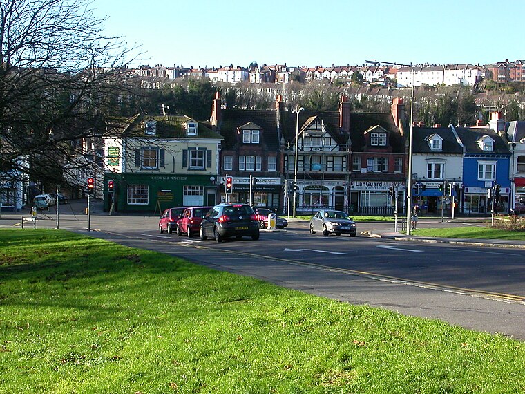
Photo: Hassocks5489, Public domain.
Preston or Preston Village is a suburb of Brighton and Hove, in the ceremonial county of East Sussex, England. It is to the north of the centre. Originally a village in its own right, it was eventually absorbed into Brighton with the development of the farmland owned by the local Stanford family, officially becoming a parish of the town in 1928.
Westdene
Suburb

Photo: The Voice of Hassocks, Public domain.
Westdene is an area of the city of Brighton and Hove, East Sussex. It is a northern suburb of the city, west of Patcham, the A23 and the London to Brighton railway line, north of Withdean and northeast of West Blatchington.
Prestonville
Suburb
Prestonville is a largely residential area in the northwest of Brighton, part of the English city of Brighton and Hove. It covers a long, narrow and steeply sloping ridge of land between the Brighton Main Line and Dyke Road, two major transport corridors which run north-northwestwards from the centre of Brighton.
Elms Lea Dentist
- Type: Dental clinic
- Address: Elms Lea Avenue, Brighton, BN1 6UG
- Categories: health care and building
- Location: Brighton and Hove, England, United Kingdom, Britain and Ireland, Europe
- View on OpenStreetMap
Latitude
50.84823° or 50° 50′ 54″ northLongitude
-0.15309° or 0° 9′ 11″ westOperator
PortmanOpen location code
9C2XRRXW+7QOpenStreetMap ID
way 1049876674OpenStreetMap feature
amenity=dentistOpenStreetMap feature
building=yesOpenStreetMap feature
healthcare=dentist
This page is based on OpenStreetMap, Wikidata, and Wikimedia Commons.
We’d love your help improving our open data sources. Thank you for contributing.
Satellite Map
Discover Elms Lea Dentist from above in high-definition satellite imagery.
Notable Places Nearby
Highlights include St Bernadette’s Catholic Primary School and Train Station.
Nearby Places
Explore places such as Varndean Road and Withdean Telephone Exchange.
England: Must-Visit Destinations
Delve into London, Manchester, Sheffield, and Leeds.
Curious Dental Clinics to Discover
Uncover intriguing dental clinics from every corner of the globe.
About Mapcarta. Data © OpenStreetMap contributors and available under the Open Database License". Text is available under the CC BY-SA 4.0 license, except for photos, directions, and the map. Photo: sidibousaid, CC BY 2.0.