Scherpinger Feld
Scherpinger Feld is a meadow in Winden, Rhein-Lahn-Kreis, Rhineland-Palatinate. Scherpinger Feld is situated nearby to the church Waldkirche, as well as near the peak Loh-Berg.| Tap on a place to explore it |
Places of Interest Nearby
Highlights include Stein’s chateau and Burg Stein.
Stein’s chateau
Castle
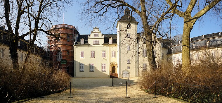
Photo: Hans G. Oberlack, CC BY-SA 4.0.
Stein’s chateau is a castle, which is situated 3½ km southwest of Scherpinger Feld.
Burg Stein
Castle
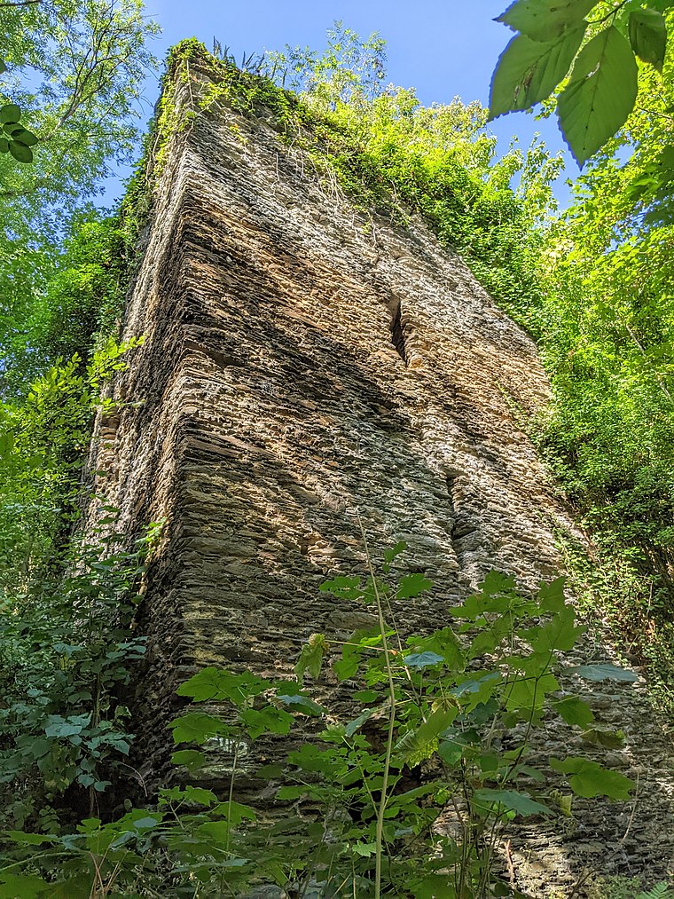
Photo: Tohma, CC BY-SA 4.0.
Burg Stein is a castle, which is situated 4 km southwest of Scherpinger Feld.
Nassau (Lahn)
Railway station

Photo: Tohma, CC BY-SA 4.0.
Nassau (Lahn) is a railway station, which is situated 3½ km south of Scherpinger Feld.
Places in the Area
Nearby places include Hübingen and Zimmerschied.
Hübingen
Village

Photo: LigaDue, CC BY-SA 4.0.
Hübingen is an Ortsgemeinde – a community belonging to a Verbandsgemeinde – in the Westerwaldkreis in Rhineland-Palatinate, Germany.
Zimmerschied
Village

Photo: LigaDue, CC BY-SA 4.0.
Zimmerschied is a municipality in the district of Rhein-Lahn, in Rhineland-Palatinate, in western Germany. It belongs to the association community of Bad Ems-Nassau. Zimmerschied is situated 2½ km west of Scherpinger Feld.
Hömberg
Village

Photo: LigaDue, CC BY-SA 4.0.
Hömberg is a municipality in the district of Rhein-Lahn, in Rhineland-Palatinate, in western Germany. It belongs to the association community of Bad Ems-Nassau. Hömberg is situated 3 km west of Scherpinger Feld.
Scherpinger Feld
- Type: Meadow
- Location: Winden, Rhein-Lahn-Kreis, Rhineland-Palatinate, Germany, Central Europe, Europe
- View on OpenStreetMap
Latitude
50.34348° or 50° 20′ 37″ northLongitude
7.81727° or 7° 49′ 2″ eastOpen location code
9F298RV8+9WOpenStreetMap ID
way 1055679290OpenStreetMap feature
landuse=meadow
This page is based on OpenStreetMap, Wikidata, and Wikimedia Commons.
We’d love your help improving our open data sources. Thank you for contributing.
Satellite Map
Discover Scherpinger Feld from above in high-definition satellite imagery.
Notable Places Nearby
Highlights include Waldkirche and Loh-Berg.
Nearby Places
Explore places such as Dorfcafé and Tierarztpraxis Lioba Wagner.
Rhineland-Palatinate: Must-Visit Destinations
Delve into Mainz, Trier, Koblenz, and Worms.
Curious Meadows to Discover
Uncover intriguing meadows from every corner of the globe.
About Mapcarta. Data © OpenStreetMap contributors and available under the Open Database License". Text is available under the CC BY-SA 4.0 license, except for photos, directions, and the map. Photo: Traveler100, CC BY-SA 3.0.