Vesilinna observation tower
Vesilinna observation tower is a scenic viewpoint in Jyväskylä, Central Finland. Vesilinna observation tower is situated nearby to Natural History Museum of Central Finland, as well as near the peak Harju.| Tap on a place to explore it |
- Type: Scenic viewpoint
- Also known as: “Vesilinnan näkötorni”
- Wheelchair access: no
Places of Interest Nearby
Highlights include Natural History Museum of Central Finland and Kirkkopuisto.

Kirkkopuisto
Park
 Kirkkopuisto is a park, which is situated 420 metres southeast of Vesilinna observation tower.
Jyväskylä City Theatre
Theater building
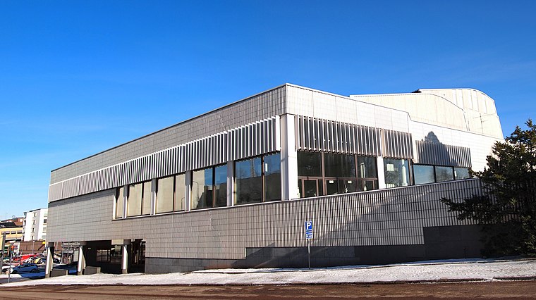
Photo: Kulmalukko, CC BY-SA 3.0.
The Jyväskylä City Theatre, founded in 1961, is the municipal theatre of the city of Jyväskylä, Finland. Jyväskylä City Theatre is situated 530 metres southeast of Vesilinna observation tower.
Places in the Area
Nearby places include Nisula and Lutakko.


Viitaniemi
Neighborhood

Photo: Yaamboo, CC BY-SA 3.0.
Viitaniemi is a neighborhood in the Nisula district of Jyväskylä, Finland. It was built during 1959–1964. In 1962, the landmark of the suburb, Viitatorni designed by Alvar Aalto, was built. Viitaniemi is considered to be an architecturally significant area.
Vesilinna observation tower
- Category: tourism
- Location: Jyväskylä, Jyväskylä, Central Finland, Finnish Lakeland, Finland, Nordic countries, Europe
- View on OpenStreetMap
Latitude
62.24317° or 62° 14′ 35″ northLongitude
25.73957° or 25° 44′ 22″ eastHeight
34 metres (112 feet)Open location code
9GJ76PVQ+7ROpenStreetMap ID
way 1057259106OpenStreetMap feature
tourism=viewpointOpenStreetMap attribute
wheelchair=no
This page is based on OpenStreetMap, Wikidata, and Wikimedia Commons.
We’d love your help improving our open data sources. Thank you for contributing.
Satellite Map
Discover Vesilinna observation tower from above in high-definition satellite imagery.
Notable Places Nearby
Highlights include Harju and Harjun ulkoilupuisto.
Nearby Places
Explore places such as Vesilinna and Pienikamari.
Central Finland: Must-Visit Destinations
Delve into Äänekoski, Jämsä, Keuruu, and Viitasaari.
Curious Scenic Viewpoints to Discover
Uncover intriguing scenic viewpoints from every corner of the globe.
About Mapcarta. Data © OpenStreetMap contributors and available under the Open Database License". Text is available under the CC BY-SA 4.0 license, except for photos, directions, and the map. Photo: Kulmalukko, CC BY-SA 4.0.