Kankaan Padel
Kankaan Padel is a sports venue in Jyväskylä, Central Finland which is located on Kympinkatu. Kankaan Padel is situated nearby to the historic building Kankaan kytkinlaitos, as well as near the park Koskipuisto.| Tap on a place to explore it |
- Opening hours: 6:00 AM—11:00 PM
- Email: kankaanpadel@gmail.com
- Type: Sports venue
- Address: Kympinkatu 7
Places of Interest Nearby
Highlights include Taulumäki Church and Jyväskylä Central Station.
Taulumäki Church
Church

Photo: Maaritti Siitonen, CC BY-SA 4.0.
Taulumäki Church is the principal Lutheran church in Jyväskylä, the administrative centre of the Central Finland region. Designed by architect Elsi Borg, its construction began in 1928. Taulumäki Church is situated 390 metres west of Kankaan Padel.
Jyväskylä Central Station
Railway station

Photo: Kulmalukko, CC BY-SA 3.0.
Jyväskylä Central Station, also known as Jyväskylä Travel Center is a transportation hub located in the city of Jyväskylä, Finland. The station is the city's main train station as well its main long-distance bus terminal. Jyväskylä Central Station is situated 1½ km south of Kankaan Padel.
Jyväskylä City Theatre
Theater building
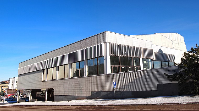
Photo: Kulmalukko, CC BY-SA 3.0.
The Jyväskylä City Theatre, founded in 1961, is the municipal theatre of the city of Jyväskylä, Finland. Jyväskylä City Theatre is situated 1½ km south of Kankaan Padel.
Places in the Area
Nearby places include Kangas and Taulumäki.


Tourula
Suburb

Photo: Wikimedia, CC BY-SA 3.0.
Tourula is a district of Jyväskylä, Finland, and a part of the Kantakaupunki ward. It is located near downtown Jyväskylä and separated from it by the river Tourujoki.
Kankaan Padel
- Categories: recreation area and sports location
- Location: Jyväskylä, Jyväskylä, Central Finland, Finnish Lakeland, Finland, Nordic countries, Europe
- View on OpenStreetMap
Latitude
62.25474° or 62° 15′ 17″ northLongitude
25.75835° or 25° 45′ 30″ eastOpen location code
9GJ77Q35+V8OpenStreetMap ID
way 1058642204OpenStreetMap feature
leisure=sports_centreOpenStreetMap feature
sport=padel
This page is based on OpenStreetMap, Wikidata, and Wikimedia Commons.
We’d love your help improving our open data sources. Thank you for contributing.
Satellite Map
Discover Kankaan Padel from above in high-definition satellite imagery.
Notable Places Nearby
Highlights include Kankaan kytkinlaitos and Koskipuisto.
Nearby Places
Explore places such as Studio Laive and Valkoinen talo.
Central Finland: Must-Visit Destinations
Delve into Äänekoski, Jämsä, Keuruu, and Viitasaari.
Curious Sports Venues to Discover
Uncover intriguing sports venues from every corner of the globe.
About Mapcarta. Data © OpenStreetMap contributors and available under the Open Database License". Text is available under the CC BY-SA 4.0 license, except for photos, directions, and the map. Photo: Kulmalukko, CC BY-SA 4.0.