Militair Complex Ried
Militair Complex Ried is a military installation in Friesland, Northern Netherlands. Militair Complex Ried is situated nearby to the pier lm57, as well as near the pitch Kaatsveld.| Tap on a place to explore it |
Places of Interest Nearby
Highlights include Walburgakerk and Dionysiuskerk.
Walburgakerk
Church
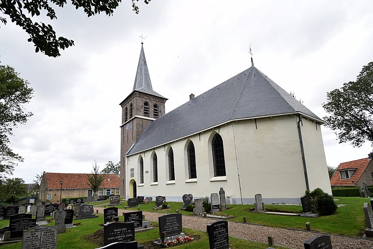
Photo: RomkeHoekstra, CC BY-SA 4.0.
Walburgakerk is a church, which is situated 1 km southwest of Militair Complex Ried.
Dionysiuskerk
Church

Photo: Wikimedia, CC BY-SA 4.0.
Dionysiuskerk is a church, which is situated 2 km southeast of Militair Complex Ried.
Ioannis Theaterchurch
Theater building

Photo: RomkeHoekstra, CC BY-SA 4.0.
Ioannis Theaterchurch is a theater building, which is situated 3 km northeast of Militair Complex Ried.
Places in the Area
Nearby places include Ried and Slappeterp.
Ried
Village

Photo: Wikimedia, CC BY-SA 4.0.
Ried is a village in Waadhoeke municipality in the province of Friesland, the Netherlands. It had a population of around 435 in January 2014.
Slappeterp
Village

Photo: Ieneach fan ‘e Esk, CC BY-SA 4.0.
Slappeterp is a small village in Waadhoeke municipality in the province of Friesland, the Netherlands. It had a population of around 85 in January 2017.
Peins
Village

Photo: RomkeHoekstra, CC BY-SA 4.0.
Peins is a village in Waadhoeke in the province of Friesland, the Netherlands. It had a population of around 170 in January 2018. Up to 2018, the village was part of the Franekeradeel municipality. Peins is situated 2½ km south of Militair Complex Ried.
Militair Complex Ried
- Type: Military installation
- Location: Friesland, Northern Netherlands, Netherlands, Benelux, Europe
- View on OpenStreetMap
Latitude
53.2276° or 53° 13′ 39″ northLongitude
5.6014° or 5° 36′ 5″ eastOperator
Ministerie van DefensieOpen location code
9F576JH2+2HOpenStreetMap ID
way 1060883857OpenStreetMap feature
landuse=military
This page is based on OpenStreetMap, Wikidata, and Wikimedia Commons.
We’d love your help improving our open data sources. Thank you for contributing.
Satellite Map
Discover Militair Complex Ried from above in high-definition satellite imagery.
Notable Places Nearby
Highlights include lm57 and Kaatsveld.
Nearby Places
Explore places such as Aldmear and Aldmear.
Friesland: Must-Visit Destinations
Delve into Leeuwarden, Heerenveen, Sneek, and Harlingen.
Curious Military Installations to Discover
Uncover intriguing military installations from every corner of the globe.
About Mapcarta. Data © OpenStreetMap contributors and available under the Open Database License". Text is available under the CC BY-SA 4.0 license, except for photos, directions, and the map. Photo: WiDi, CC BY-SA 3.0.