Old Park Farm
Old Park Farm is a farm in Holton, South Oxfordshire District, England. Old Park Farm is situated nearby to the forest Cottage Copse, as well as near the hamlet Holton.| Tap on a place to explore it |
Places of Interest Nearby
Highlights include Church of St Bartholomew, Holton and The Kings Arms Public House.
Church of St Bartholomew, Holton
Church

Photo: Steve Daniels, CC BY-SA 2.0.
Church of St Bartholomew, Holton is situated 2,600 feet south of Old Park Farm.
The Kings Arms Public House
Pub

Photo: al partington, CC BY-SA 2.0.
The Kings Arms Public House is situated 1 mile southwest of Old Park Farm.
The Sun Inn
Pub
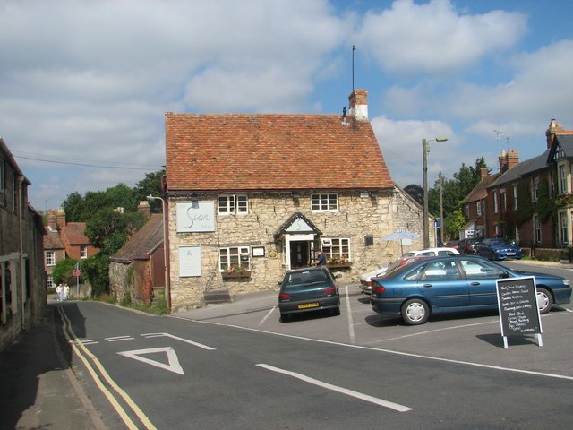
Photo: Roy Parkhouse, CC BY-SA 2.0.
The Sun Inn is a pub, which is situated 1¼ miles southwest of Old Park Farm.
Places in the Area
Nearby places include Holton and Wheatley.
Holton
Hamlet

Photo: Motacilla, CC BY-SA 3.0.
Holton is a village and civil parish in South Oxfordshire about 5.5 miles east of Oxford. The parish is bounded to the southeast by the River Thame, to the east and north by the Thame's tributary Holton Brook, to the south by London Road and to the west by field boundaries with the parishes of Forest Hill with Shotover and Stanton St John.
Wheatley
Village

Photo: Chris Heaton, CC BY-SA 2.0.
Wheatley is a village and civil parish in South Oxfordshire, England, about 5 miles east of Oxford. The parish includes the hamlet of Littleworth, which is west of Wheatley.
Waterperry
Hamlet

Photo: Wikimedia, Public domain.
Waterperry is a village in the civil parish of Waterperry with Thomley, in the South Oxfordshire district of Oxfordshire, England. It lies about 7 miles east of Oxford and is in the valley of the River Thame, close to the county boundary with Buckinghamshire.
Old Park Farm
- Type: Farm
- Category: agriculture
- Location: Holton, South Oxfordshire District, Oxfordshire, South East England, England, United Kingdom, Britain and Ireland, Europe
- View on OpenStreetMap
Latitude
51.75992° or 51° 45′ 36″ northLongitude
-1.12174° or 1° 7′ 18″ westOpen location code
9C3WQV5H+X8OpenStreetMap ID
way 1067862320OpenStreetMap feature
landuse=farmyard
This page is based on OpenStreetMap, Wikidata, and Wikimedia Commons.
We’d love your help improving our open data sources. Thank you for contributing.
Satellite Map
Discover Old Park Farm from above in high-definition satellite imagery.
Places with the Same Name
Discover other places named “Old Park Farm”.
Notable Places Nearby
Highlights include Cottage Copse and Holton Village Hall.
Nearby Places
Explore places such as Ox Meadow House and Pond Farm (Holton) SPS.
Oxfordshire: Must-Visit Destinations
Delve into Oxford, Abingdon-on-Thames, Banbury, and Woodstock.
Curious Farms to Discover
Uncover intriguing farms from every corner of the globe.
About Mapcarta. Data © OpenStreetMap contributors and available under the Open Database License". Text is available under the CC BY-SA 4.0 license, except for photos, directions, and the map. Photo: Wikimedia, CC0.