Romans Care Home
Romans Care Home is a social service facility in Adur District, West Sussex, England. Romans Care Home is situated nearby to Southwick Methodist Church, as well as near Southwick Christian Community Church.| Tap on a place to explore it |
Places of Interest Nearby
Highlights include Southwick railway station and St Michael and All Angels Church, Southwick.
Southwick railway station
Railway station
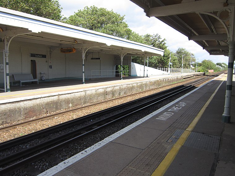
Photo: My another account, CC0.
Southwick railway station serves the town of Southwick in West Sussex, England. It is on the West Coastway Line, 4 miles 30 chains from Brighton. It is operated by Southern. Its platforms are long enough for eight-coach trains. Southwick railway station is situated 2,400 feet south of Romans Care Home.
St Michael and All Angels Church, Southwick
Church

Photo: The Voice of Hassocks, Public domain.
St Michael and All Angels Church is an Anglican church in the town of Southwick in the English district of Adur. It was rebuilt in the 12th and 13th centuries, with some Anglo-Saxon era structural work remaining; a church may have existed on the site as early as the 10th century—before the ancient settlement of Southwick took that name. St Michael and All Angels Church, Southwick is situated 2,100 feet southwest of Romans Care Home.
Fishersgate railway station
Railway station

Photo: Peter Holmes, CC BY-SA 2.0.
Fishersgate railway station is a railway station in West Sussex, England, serving both the eastern part of Southwick, as well as the western part of Portslade in Brighton and Hove. Fishersgate railway station is situated 3,900 feet southeast of Romans Care Home.
Places in the Area
Nearby places include Southwick and Kingston by Sea.
Southwick
Town

Photo: The Voice of Hassocks, Public domain.
Southwick is a town in the Adur district of West Sussex, England located five miles west of Brighton. It covers an area of 863.7 ha. In 2001 it had a population of 13,195.
Kingston by Sea
Village

Photo: Simon Carey, CC BY-SA 2.0.
Kingston by Sea, also known as Kingston Buci, Kingston Bucii or simply Kingston, is a small area in the Adur district of West Sussex, England. Although it is now part of a continuous urban area, its origins lay in an ancient village and parish church between…
Mile Oak
Suburb

Photo: Hassocks5489, CC0.
Mile Oak is a locality forming the northern part of the former parish of Portslade in the northwest corner of the city of Brighton and Hove, England. Now mostly residential, but originally an area of good-quality agricultural land, it covers the area north of Portslade village as far as the urban boundary.
Romans Care Home
- Type: Social service facility
- Address: Brighton, BN42 4TP
- Category: building
- Location: Adur District, West Sussex, South East England, England, United Kingdom, Britain and Ireland, Europe
- View on OpenStreetMap
Latitude
50.83882° or 50° 50′ 20″ northLongitude
-0.23485° or 0° 14′ 5″ westOpen location code
9C2XRQQ8+G3OpenStreetMap ID
way 1078554429OpenStreetMap feature
amenity=social_facilityOpenStreetMap feature
building=yes
This page is based on OpenStreetMap, Wikidata, and Wikimedia Commons.
We’d love your help improving our open data sources. Thank you for contributing.
Satellite Map
Discover Romans Care Home from above in high-definition satellite imagery.
Notable Places Nearby
Highlights include Southwick Methodist Church and Southwick Christian Community Church.
Nearby Places
Explore places such as Southwick Nursery Ltd and Philip Evans Funeral Services.
West Sussex: Must-Visit Destinations
Delve into Chichester, Crawley, Worthing, and Horsham.
Curious Social Service Facilities to Discover
Uncover intriguing social service facilities from every corner of the globe.
About Mapcarta. Data © OpenStreetMap contributors and available under the Open Database License". Text is available under the CC BY-SA 4.0 license, except for photos, directions, and the map. Photo: wildlife encounters, CC BY 2.0.