Kampel Forst- u. Gartengeräte
Kampel Forst- u. Gartengeräte is a hardware store in Bruck an der Leitha, Lower Austria which is located on Färberstraße. Kampel Forst- u. Gartengeräte is situated nearby to Fire station in Bruck an der Leitha, as well as near the church Königreichssaal.| Tap on a place to explore it |
- Opening hours: Monday—Friday 8:00 AM—noon and 1:00 PM—5:00 PM
- Type: Hardware store
- Address: Färberstraße 14, Bruck an der Leitha, 2460
Places of Interest Nearby
Highlights include Fire station in Bruck an der Leitha and Prugg Castle.
Fire station in Bruck an der Leitha
Fire station

Photo: Wikimedia, CC BY-SA 4.0.
Fire station in Bruck an der Leitha is situated 200 metres south of Kampel Forst- u. Gartengeräte.
Prugg Castle
Castle

Photo: Bwag, CC BY-SA 4.0.
Prugg Castle is situated 1 km southwest of Kampel Forst- u. Gartengeräte.
Saint Matthew church in Bruck an der Leitha
Church

Photo: Bwag, CC BY-SA 4.0.
Saint Matthew church in Bruck an der Leitha is situated 1 km southwest of Kampel Forst- u. Gartengeräte.
Places in the Area
Nearby places include Höflein and Rohrau.
Höflein
Village
Höflein is a town in the district of Bruck an der Leitha in Lower Austria in Austria. Höflein is situated 4 km north of Kampel Forst- u. Gartengeräte.
Rohrau
Village
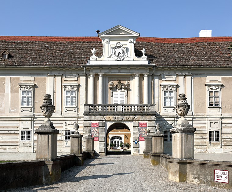
Photo: Bwag, CC BY-SA 4.0.
Rohrau is a village in the state of Lower Austria. The name comes from two German words: Rohr and Au. South of the village is a riparian forest and a swamp covered with reed. Rohrau is situated 6 km northeast of Kampel Forst- u. Gartengeräte.
Scharndorf
Village
Scharndorf is a town in the district of Bruck an der Leitha in Lower Austria in Austria. Scharndorf is situated 7 km north of Kampel Forst- u. Gartengeräte.
Kampel Forst- u. Gartengeräte
- Categories: building and shop
- Location: Bruck an der Leitha, Bruck an der Leitha District, Lower Austria, Austria, Central Europe, Europe
- View on OpenStreetMap
Latitude
48.03275° or 48° 1′ 58″ northLongitude
16.78803° or 16° 47′ 17″ eastOpen location code
8FWR2QMQ+36OpenStreetMap ID
way 108536604OpenStreetMap feature
building=yesOpenStreetMap feature
shop=doityourself
This page is based on OpenStreetMap, Wikidata, and Wikimedia Commons.
We’d love your help improving our open data sources. Thank you for contributing.
Satellite Map
Discover Kampel Forst- u. Gartengeräte from above in high-definition satellite imagery.
Notable Places Nearby
Highlights include Königreichssaal and Sportareal Leithana.
Nearby Places
Explore places such as Fernwärme Bruck - Lager and Fernwärme Bruck.
Lower Austria: Must-Visit Destinations
Delve into St. Pölten, Wiener Neustadt, Amstetten, and Klosterneuburg.
Curious Hardware Stores to Discover
Uncover intriguing hardware stores from every corner of the globe.
About Mapcarta. Data © OpenStreetMap contributors and available under the Open Database License". Text is available under the CC BY-SA 4.0 license, except for photos, directions, and the map. Photo: Lonezor, CC BY-SA 3.0.