De Rimboe
De Rimboe is a chalet in Apeldoorn, Veluwe, Gelderland. De Rimboe is situated nearby to the nature reserve Varenna, as well as near Schenkenshul.| Tap on a place to explore it |
Places of Interest Nearby
Highlights include Heldringkerk and Twee halve bollen.
Heldringkerk
Church

Photo: Michielverbeek, CC BY-SA 3.0.
Heldringkerk is a church, which is situated 3½ km west of De Rimboe.
Twee halve bollen
Work of art
 Twee halve bollen is a work of art, which is situated 2½ km southeast of De Rimboe.

Places in the Area
Nearby places include Woeste Hoeve and Hoenderloo.
Woeste Hoeve
Hamlet
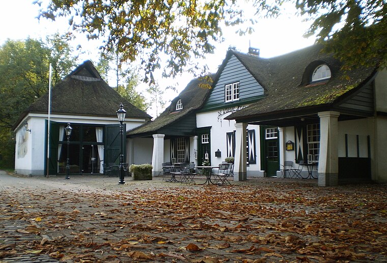
Photo: Apdency, Public domain.
De Woeste Hoeve is a hamlet in the Netherlands between Apeldoorn and Arnhem, which is remembered for an incident in the Second World War when, during the night of 6 March 1945, Dutch resistance fighters shot the Nazi Chief of Police, SS General Hanns Rauter.
Hoenderloo
Village

Photo: Ben Bender, CC BY-SA 3.0.
Hoenderloo is a Dutch village located south west of the city of Apeldoorn. Most of the village is part of the municipality of Apeldoorn, but a small part belongs to the municipality of Ede, among which the hamlet Hoog Baarlo. Hoenderloo is situated 3½ km west of De Rimboe.

De Rimboe
- Type: Chalet
- Categories: tourism, accommodation, and building
- Location: Apeldoorn, Veluwe, Gelderland, Eastern Netherlands, Netherlands, Benelux, Europe
- View on OpenStreetMap
Latitude
52.12062° or 52° 7′ 14″ northLongitude
5.92861° or 5° 55′ 43″ eastOpen location code
9F474WCH+6COpenStreetMap ID
way 1090992162OpenStreetMap feature
tourism=chalet
This page is based on OpenStreetMap, Wikidata, and Wikimedia Commons.
We’d love your help improving our open data sources. Thank you for contributing.
Satellite Map
Discover De Rimboe from above in high-definition satellite imagery.
Notable Places Nearby
Highlights include Varenna and Schenkenshul.
Nearby Places
Explore places such as Brasserie de Kleine Trek and Krimdal.
Veluwe: Must-Visit Destinations
Delve into Ede, Wageningen, Harderwijk, and Elburg.
Curious Chalets to Discover
Uncover intriguing chalets from every corner of the globe.
About Mapcarta. Data © OpenStreetMap contributors and available under the Open Database License". Text is available under the CC BY-SA 4.0 license, except for photos, directions, and the map. Photo: Kleinleugenmors, CC BY-SA 3.0.