Long Rough
Long Rough is a forest in Ashington, Horsham District, England. Long Rough is situated nearby to the hamlet Spear Hill, as well as near the village Ashington.| Tap on a place to explore it |
Places of Interest
Highlights include Church of the Holy Sepulchre and The Parish Church of St Peter and St Paul.
Church of the Holy Sepulchre
Church

Photo: Dave Spicer, CC BY-SA 2.0.
The Church of the Holy Sepulchre is a former Anglican church in the hamlet of Warminghurst in the district of Horsham, one of seven local government districts in the English county of West Sussex.
All Saints Church
Church

Photo: Simon Carey, CC BY-SA 2.0.
All Saints Church is an Anglican church in the hamlet of Buncton in the district of Horsham, one of seven local government districts in the English county of West Sussex.
Places in the Area
Nearby places include Ashington and Ashurst.
Ashington
Village
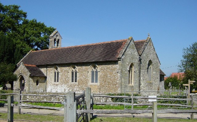
Photo: Janine Forbes, CC BY-SA 2.0.
Ashington is a village and civil parish in the Horsham District of West Sussex, England. It lies on the A24 road 3 miles north-east of Storrington. The parish has a land area of 805 hectares.
Ashurst
Village

Photo: Antiquary, CC BY-SA 4.0.
Ashurst is a village and civil parish in the Horsham District of West Sussex, England, about 2 miles west of Henfield and 11 miles south of Horsham, on the B2135 road.
Washington
Village

Photo: Charlesdrakew, Public domain.
Washington is a village and civil parish in the Horsham District of West Sussex, England. It is located five miles west of Steyning and three miles east of Storrington on the A24 between Horsham and Worthing.
Long Rough
Latitude
50.9404° or 50° 56′ 26″ northLongitude
-0.3783° or 0° 22′ 42″ westOpen location code
9C2XWJRC+5MOpenStreetMap ID
way 1091385275OpenStreetMap feature
natural=wood
This page is based on OpenStreetMap, Wikidata, and Wikimedia Commons.
We’d love your help improving our open data sources. Thank you for contributing.
Satellite Map
Discover Long Rough from above in high-definition satellite imagery.
Localities in the Area
Explore places such as Spear Hill and Platt’s Green.
Notable Places Nearby
Highlights include Calves Croft and Basing Wood.
West Sussex: Must-Visit Destinations
Delve into Chichester, Crawley, Worthing, and Horsham.
Curious Forests to Discover
Uncover intriguing forests from every corner of the globe.
About Mapcarta. Data © OpenStreetMap contributors and available under the Open Database License". Text is available under the CC BY-SA 4.0 license, except for photos, directions, and the map. Photo: wildlife encounters, CC BY 2.0.