iLEAD Lancaster Charter School
iLEAD Lancaster Charter School is a school in Los Angeles, Southern California, California. iLEAD Lancaster Charter School is situated nearby to the government office Los Angeles County Assessor, as well as near the bowling alley Bowlero.| Tap on a place to explore it |
Places of Interest Nearby
Highlights include Lancaster Museum of Art and History and Lancaster station.
Lancaster Museum of Art and History
Museum
The Lancaster Museum of Art and History, is located in Lancaster, California. The museum's exhibits focus on post-war American art with an emphasis on California art. Lancaster Museum of Art and History is situated 2 miles northwest of iLEAD Lancaster Charter School.
Lancaster station
Railway station
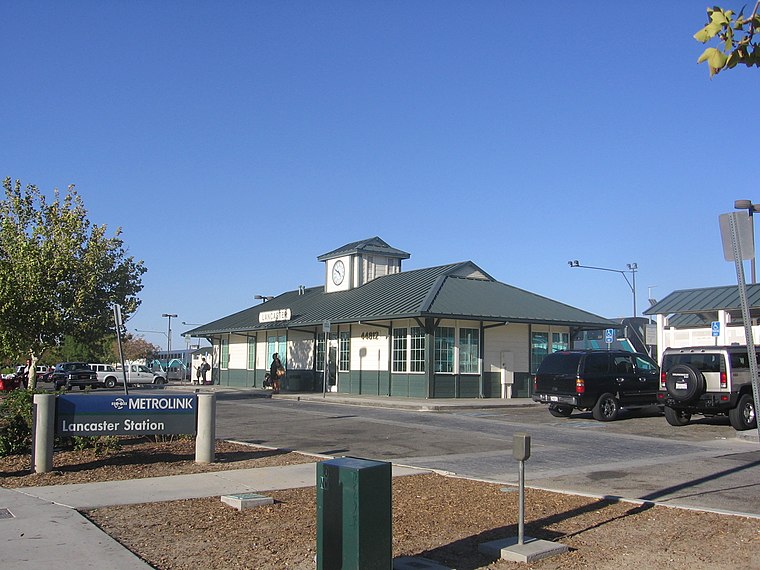
Photo: Pedro Xing, CC0.
Lancaster station is owned by and located in the city of Lancaster, California. It serves as a transfer point for several public transportation bus routes as well as the final Metrolink train station on the Antelope Valley Line that originates 69 miles away in downtown Los Angeles, at Union Station. Lancaster station is situated 2 miles north of iLEAD Lancaster Charter School.
Antelope Valley Hospital
Hospital
Antelope Valley Medical Center is a district hospital located in Lancaster, California specializing in acute care. It has 420 beds and is accredited by the Joint Commission. In March 2010 AVMC was declared one of the 14 trauma centers in Los Angeles County. Antelope Valley Hospital is situated 2 miles northwest of iLEAD Lancaster Charter School.
Places in the Area
Nearby places include Lancaster and Quartz Hill.
Lancaster

Photo: Wikimedia, CC BY-SA 2.0.
Lancaster is a city in far northern Los Angeles County in Southern California, 8 miles from the Kern County line.
Quartz Hill
Town
Quartz Hill is an unincorporated community in Los Angeles County, California, United States. The name is also shared with the neighboring district areas of its border cities, Palmdale, and Lancaster. Quartz Hill is situated 6 miles west of iLEAD Lancaster Charter School.
Desert View Highlands
Locality
Desert View Highlands is an unincorporated community and census designated place in Los Angeles County, California, United States. The population was 2,676 at the 2020 census, up from 2,360 at the 2010 census. It is surrounded by the City of Palmdale. Desert View Highlands is situated 6 miles south of iLEAD Lancaster Charter School.
iLEAD Lancaster Charter School
- Type: School
- Category: education
- Location: Los Angeles, Southern California, California, United States, North America
- View on OpenStreetMap
Latitude
34.67085° or 34° 40′ 15″ northLongitude
-118.12609° or 118° 7′ 34″ westOpen location code
8563MVCF+8HOpenStreetMap ID
way 1094679924OpenStreetMap feature
amenity=school
This page is based on OpenStreetMap, Wikidata, and Wikimedia Commons.
We’d love your help improving our open data sources. Thank you for contributing.
Satellite Map
Discover iLEAD Lancaster Charter School from above in high-definition satellite imagery.
Notable Places Nearby
Highlights include Los Angeles County Assessor and Bowlero.
Nearby Places
Explore places such as FedEx Ship Center and CubeSmart.
Los Angeles: Must-Visit Destinations
Delve into Hollywood, San Gabriel Valley, San Fernando Valley, and Long Beach.
Curious Schools to Discover
Uncover intriguing schools from every corner of the globe.
About Mapcarta. Data © OpenStreetMap contributors and available under the Open Database License". Text is available under the CC BY-SA 4.0 license, except for photos, directions, and the map. Photo: Mfield, CC BY-SA 3.0.