Barroway Drove Hootens Row STW
Barroway Drove Hootens Row STW is a wastewater treatment plant in Stow Bardolph, King’s Lynn and West Norfolk District, England. Barroway Drove Hootens Row STW is situated nearby to Willows Nature Reserve, as well as near the town Downham Market.| Tap on a place to explore it |
Places of Interest Nearby
Highlights include Downham Market railway station and Church of St Peter.
Downham Market railway station
Railway station

Photo: Andy F, CC BY-SA 2.0.
Downham Market railway station is on the Fen line in the east of England, serving the town of Downham Market, Norfolk. It is 86 miles 8 chains measured from London Liverpool Street and is situated between Littleport and Watlington stations. Downham Market railway station is situated 2 miles east of Barroway Drove Hootens Row STW.
Church of St Peter
Church

Photo: Jonathan Thacker, CC BY-SA 2.0.
Church of St Peter is situated 2 miles northeast of Barroway Drove Hootens Row STW.
Nelson Academy
School
Downham Market, sometimes simply referred to as Downham, is a market town and civil parish in Norfolk, England. It is on the edge of the Fens, on the River Great Ouse, approximately 11 miles south of King's Lynn, 39 miles west of Norwich, and 30 miles north of Cambridge. Nelson Academy is situated 2½ miles east of Barroway Drove Hootens Row STW.
Places in the Area
Nearby places include Downham Market and Stowbridge.
Downham Market
Town

Photo: Uksignpix, CC BY-SA 3.0.
Downham Market, sometimes simply referred to as Downham, is a market town and civil parish in Norfolk, England. It is on the edge of the Fens, on the River Great Ouse, approximately 11 miles south of King's Lynn, 39 miles west of Norwich, and 30 miles north of Cambridge. Downham Market is situated 2½ miles east of Barroway Drove Hootens Row STW.
Stowbridge
Village

Photo: Ben Harris, CC BY-SA 2.0.
Stowbridge or Stow Bridge is a village in the parish of Stow Bardolph, extending into Wiggenhall St Mary Magdalen, in the English county of Norfolk. The parish of Stow Bardolph also includes Barroway Drove. Stowbridge is situated 3 miles northeast of Barroway Drove Hootens Row STW.
Bexwell
Village
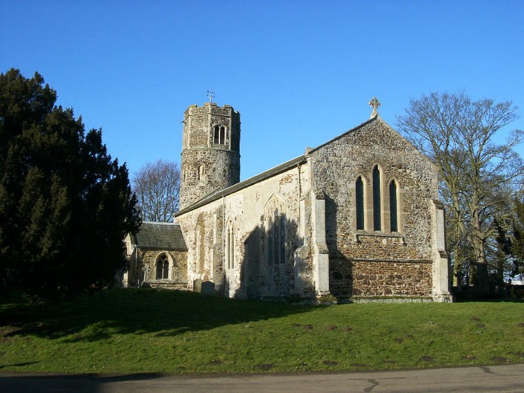
Photo: Pommes104, CC BY-SA 3.0.
Bexwell is a small village and former civil parish in the English county of Norfolk. It is located within the parish of Ryston and is located 1 mile from Downham Market. Bexwell is situated 3½ miles east of Barroway Drove Hootens Row STW.
Barroway Drove Hootens Row STW
Latitude
52.61088° or 52° 36′ 39″ northLongitude
0.31996° or 0° 19′ 12″ eastOperator
Anglian WaterOpen location code
9F42J869+9XOpenStreetMap ID
way 1113111791OpenStreetMap feature
man_made=wastewater_plant
This page is based on OpenStreetMap, Wikidata, and Wikimedia Commons.
We’d love your help improving our open data sources. Thank you for contributing.
Satellite Map
Discover Barroway Drove Hootens Row STW from above in high-definition satellite imagery.
Notable Places Nearby
Highlights include Poplar Farm Airstrip and The Railway Arms.
Nearby Places
Explore places such as The Chase, adj and village hall, adj.
Norfolk: Must-Visit Destinations
Delve into Norwich, King’s Lynn, Great Yarmouth, and Norfolk Broads.
Curious Wastewater Treatment Plants to Discover
Uncover intriguing wastewater treatment plants from every corner of the globe.
About Mapcarta. Data © OpenStreetMap contributors and available under the Open Database License". Text is available under the CC BY-SA 4.0 license, except for photos, directions, and the map. Photo: matthewhartley369, CC BY-SA 2.0.