Thorpe Malsor STW
Thorpe Malsor STW is a wastewater treatment plant in Thorpe Malsor, Kettering District, England. Thorpe Malsor STW is situated nearby to the forest Breakmill Spinney, as well as near Church of St Leonard, Thorpe Malsor.| Tap on a place to explore it |
Places of Interest Nearby
Highlights include Church of St Leonard, Thorpe Malsor and Kettering General Hospital.
Church of St Leonard, Thorpe Malsor
Church
The Church of St Leonard is a Grade II* listed English parish church in Thorpe Malsor, Northamptonshire. Renovations carried out in 1877 by Clapton Rolfe of Reading somewhat altered the character of its mediaeval structures. Church of St Leonard, Thorpe Malsor is situated 1,300 feet northwest of Thorpe Malsor STW.
Kettering General Hospital
Hospital
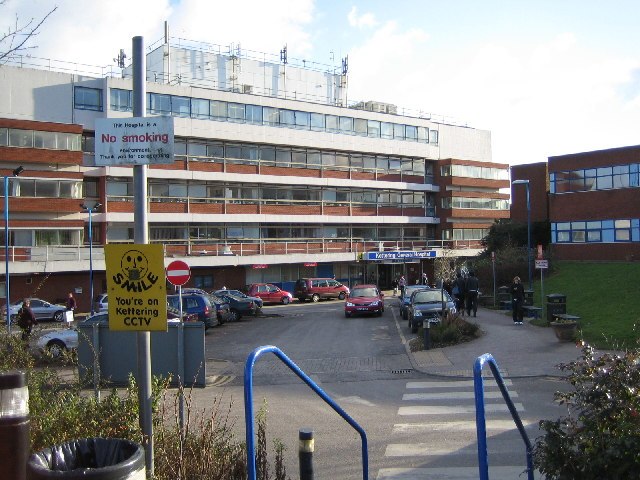
Photo: John Winterbottom, CC BY-SA 2.0.
Kettering General Hospital is an NHS district hospital in Kettering, Northamptonshire, England. Mainly serving the unitary authority area of North Northamptonshire, it is managed by the Kettering General Hospital NHS Foundation Trust. Kettering General Hospital is situated 1¼ miles east of Thorpe Malsor STW.
Kettering railway station
Railway station
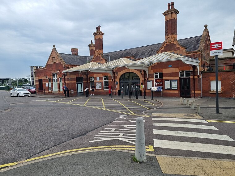
Photo: Bearas, CC BY-SA 4.0.
Kettering railway station serves the market and industrial town of Kettering, in Northamptonshire, England. It lies south-west of the town centre, on the Midland Main Line, 71 miles north of London St. Pancras. Kettering railway station is situated 1½ miles east of Thorpe Malsor STW.
Places in the Area
Nearby places include Kettering and Rothwell.
Kettering

Photo: Wikimedia, CC BY-SA 2.0.
Kettering is a town of 60,749 people in north Northamptonshire. Kettering owes much of its heritage and growth to the arrival of the railway during the mid-1800s.
Rothwell
Town

Photo: Immanuel Giel, CC BY-SA 3.0.
Rothwell is a market town in North Northamptonshire, England. It is situated 4 miles northwest of Kettering, 7 miles southeast of Market Harborough, and 8 miles southwest of Corby. Rothwell's nearest railway station is at Kettering on the Midland Main Line. Rothwell is situated 2 miles northwest of Thorpe Malsor STW.
Desborough
Town
Desborough is a town in North Northamptonshire, England, lying in the Ise Valley between Market Harborough and Kettering. It was an industrial centre for weaving and shoe-making in the 19th century and had a long association with the Co-operative movement. Desborough is situated 3½ miles northwest of Thorpe Malsor STW.
Thorpe Malsor STW
- Type: Wastewater treatment plant
- Category: industry
- Location: Thorpe Malsor, Kettering District, North Northamptonshire, England, United Kingdom, Britain and Ireland, Europe
- View on OpenStreetMap
Latitude
52.40085° or 52° 24′ 3″ northLongitude
-0.77117° or 0° 46′ 16″ westOperator
Anglian WaterOpen location code
9C4XC62H+8GOpenStreetMap ID
way 1113176033OpenStreetMap feature
man_made=wastewater_plant
This page is based on OpenStreetMap, Wikidata, and Wikimedia Commons.
We’d love your help improving our open data sources. Thank you for contributing.
Satellite Map
Discover Thorpe Malsor STW from above in high-definition satellite imagery.
Notable Places Nearby
Highlights include Breakmill Spinney and Thorpe Malsor Village Hall.
Nearby Places
Explore places such as Rookery Cottage and The Square (opp).
England: Must-Visit Destinations
Delve into London, Manchester, Sheffield, and Leeds.
Curious Wastewater Treatment Plants to Discover
Uncover intriguing wastewater treatment plants from every corner of the globe.
About Mapcarta. Data © OpenStreetMap contributors and available under the Open Database License". Text is available under the CC BY-SA 4.0 license, except for photos, directions, and the map. Photo: sidibousaid, CC BY 2.0.