Hollin Gate
Hollin Gate is a residential area in Kirklees, England. Hollin Gate is situated nearby to the village Linthwaite, as well as near Christ Church.| Tap on a place to explore it |
Places of Interest Nearby
Highlights include Christ Church and Huddersfield Narrow Canal; Scarwood Bridge.

Huddersfield Narrow Canal; Scarwood Bridge
Bridge

Photo: Ian S, CC BY-SA 2.0.
Huddersfield Narrow Canal; Scarwood Bridge is situated 3,700 feet north of Hollin Gate.
Slaithwaite railway station
Railway station
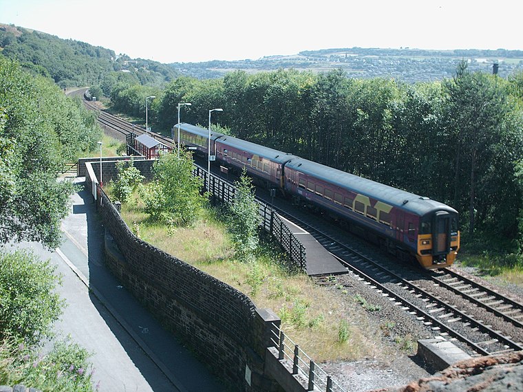 Slaithwaite railway station serves the town of Slaithwaite, West Yorkshire, England. The station is 4 miles west of Huddersfield railway station on the Huddersfield Line between Huddersfield and Manchester Victoria. Slaithwaite railway station is situated 1¼ miles west of Hollin Gate.
Places in the Area
Nearby places include Linthwaite and South Crosland.
Linthwaite
Village

Photo: Richard Harvey, CC BY-SA 3.0.
Linthwaite is a village in the Kirklees district, in West Yorkshire, England. Historically part of the West Riding of Yorkshire, it is situated 4 miles west of Huddersfield, on the A62 in the Colne Valley.
South Crosland
Village
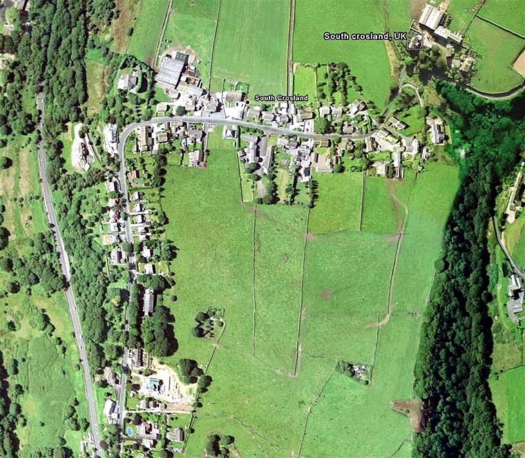
Photo: Wikimedia, Public domain.
South Crosland is a village in the metropolitan borough of Kirklees in West Yorkshire, England.
Slaithwaite
Village
 Slaithwaite is a town in the Kirklees district of West Yorkshire, England. Historically part of the West Riding of Yorkshire, it is in the Colne Valley and on the Huddersfield Narrow Canal, 5 miles south-west of Huddersfield.
Hollin Gate
- Type: Residential area
- Location: Kirklees, England, United Kingdom, Britain and Ireland, Europe
- View on OpenStreetMap
Latitude
53.62214° or 53° 37′ 20″ northLongitude
-1.85067° or 1° 51′ 2″ westOpen location code
9C5WJ4CX+VPOpenStreetMap ID
way 1116572596OpenStreetMap feature
landuse=residential
This page is based on OpenStreetMap, Wikidata, and Wikimedia Commons.
We’d love your help improving our open data sources. Thank you for contributing.
Satellite Map
Discover Hollin Gate from above in high-definition satellite imagery.
Notable Places Nearby
Highlights include Linthwaite Methodist Chapel and Linthwaite Ardron CofE (Voluntary Aided) Junior and Infant School.
Nearby Places
Explore places such as Gillroyd Lane Causeway Side and Waingate The Ridgeways.
England: Must-Visit Destinations
Delve into London, Manchester, Sheffield, and Leeds.
Curious Residential Areas to Discover
Uncover intriguing residential areas from every corner of the globe.
About Mapcarta. Data © OpenStreetMap contributors and available under the Open Database License". Text is available under the CC BY-SA 4.0 license, except for photos, directions, and the map. Photo: sidibousaid, CC BY 2.0.