Mz.366
Mz.366 is a residential area in Goya Department, Corrientes. Mz.366 is situated nearby to the place of worship iglesia la rotonda San Roque y San Jacinto, as well as near the church Mz.358.| Tap on a place to explore it |
Places of Interest Nearby
Highlights include Nuestra Señora del Rosario 2.
Nuestra Señora del Rosario 2
Church
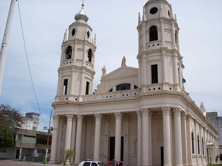
Photo: Alpertron, CC BY-SA 3.0.
Nuestra Señora del Rosario 2 is a church, which is situated 1½ km northeast of Mz.366.
Places in the Area
Nearby places include Goya.
Goya
Town
Photo: Alpertron, CC BY-SA 3.0.
Goya is a city in the south-west of the province of Corrientes in the Argentine Mesopotamia. It has about 106,368 inhabitants as of the 2022 census. The city lies on the eastern shore of the Paraná River, opposite Reconquista, Santa Fe, 218 kilometres south from the provincial capital and 715 kilometres north-northwest from Buenos Aires.
Mz.366
- Type: Residential area
- Location: Goya Department, Corrientes, Mesopotamia, Argentina, South America
- View on OpenStreetMap
Latitude
-29.15295° or 29° 9′ 11″ southLongitude
-59.2759° or 59° 16′ 33″ westOpen location code
5822RPWF+RJOpenStreetMap ID
way 1117110749OpenStreetMap feature
landuse=residential
This page is based on OpenStreetMap, Wikidata, and Wikimedia Commons.
We’d love your help improving our open data sources. Thank you for contributing.
Satellite Map
Discover Mz.366 from above in high-definition satellite imagery.
Notable Places Nearby
Highlights include iglesia la rotonda San Roque y San Jacinto and Mz.358.
Nearby Places
Explore places such as Escuela Parroquial La Rotonda and Mz.373.
Corrientes: Must-Visit Destinations
Delve into Corrientes, Paso de los Libres, Mercedes, and Esquina.
Curious Residential Areas to Discover
Uncover intriguing residential areas from every corner of the globe.
About Mapcarta. Data © OpenStreetMap contributors and available under the Open Database License". Text is available under the CC BY-SA 4.0 license, except for photos, directions, and the map. Photo: Wikimedia, CC0.