Southwold Primary School
Southwold Primary School is a school in Hackney, Greater London, England which is located on Detmold Road. Southwold Primary School is situated nearby to Leaways School, as well as near the arts center Cell Studios.| Tap on a place to explore it |
- Type: School
- Description: school in Hackney, UK
- Address: Detmold Road, London, E5 9NL
Places of Interest Nearby
Highlights include Lee Valley and Clapton railway station.
Lee Valley
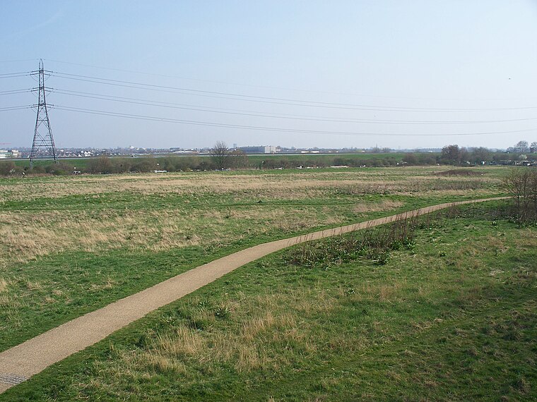
Photo: Iridescent, CC BY-SA 3.0.
The Lee Valley Regional Park is a 26-mile long park in Essex, Hertfordshire and London in England. It has had a special legal status for almost 80 years, set aside "for recreation, sport, entertainment and the enjoyment of leisure".
Clapton railway station
Railway station
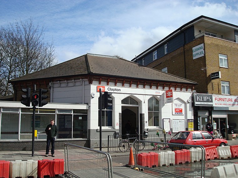
Photo: Stacey Harris, CC BY-SA 2.0.
Clapton is a station on the Weaver line of the London Overground, located in Clapton in the London Borough of Hackney. It is 3 miles 78 chains down the line from London Liverpool Street and is situated between Hackney Downs and St. James Street on the Chingford branch line. Clapton railway station is situated 940 feet southwest of Southwold Primary School.
St Matthew
Church

Photo: Wikimedia, CC BY-SA 2.0.
St Matthew is a church, which is situated 790 feet north of Southwold Primary School.
Places in the Area
Nearby places include Clapton and Upper Clapton.
Clapton
Suburb
Clapton is a district of east London, England, in the London Borough of Hackney. Clapton is divided into Upper Clapton, in the north, and Lower Clapton to the south. Clapton railway station lies 4.7 miles north-east of Charing Cross.
Upper Clapton
Quarter

Photo: Tarquin Binary, CC BY-SA 2.5.
Clapton is a district of east London, England, in the London Borough of Hackney. Clapton is divided into Upper Clapton, in the north, and Lower Clapton to the south. Clapton railway station lies 4.7 miles north-east of Charing Cross.

Southwold Primary School
- Categories: community school, primary school, and education
- Location: Hackney, Greater London, London, England, United Kingdom, Britain and Ireland, Europe
- View on OpenStreetMap
Latitude
51.5633° or 51° 33′ 48″ northLongitude
-0.05368° or 0° 3′ 13″ westOperator
London Borough of HackneyOpen location code
9C3XHW7W+8GOpenStreetMap ID
way 113422061OpenStreetMap feature
amenity=schoolWikidata ID
Q67147472
This page is based on OpenStreetMap, Wikidata, and Wikimedia Commons.
We’d love your help improving our open data sources. Thank you for contributing.
Satellite Map
Discover Southwold Primary School from above in high-definition satellite imagery.
Places with the Same Name
Discover other places named “Southwold Primary School”.
Notable Places Nearby
Highlights include Leaways School and Cell Studios.
Nearby Places
Explore places such as E5 Cafe and Restaurant and Regal Buildings.
London: Must-Visit Destinations
Delve into South Kensington-Chelsea, Heathrow Airport, City of London, and Westminster.
Curious Schools to Discover
Uncover intriguing schools from every corner of the globe.
About Mapcarta. Data © OpenStreetMap contributors and available under the Open Database License". Text is available under the CC BY-SA 4.0 license, except for photos, directions, and the map. Photo: Laurencefwhite, CC BY 2.5.