Witt’n Hus
Witt’n Hus is a social service facility in Lebrade, Plön, Schleswig-Holstein which is located on Lannweg. Witt’n Hus is situated nearby to the church Ev-Luth. Kirche Lebrade, as well as near the fire station Freiwillige Feuerwehr Lebrade.| Tap on a place to explore it |
Places of Interest Nearby
Highlights include Lebrade Pond Bird Sanctuary and Rottensee.
Lebrade Pond Bird Sanctuary
Nature reserve
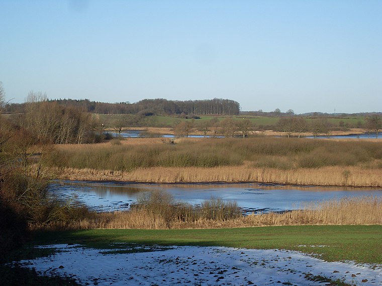
Photo: Wusel007, CC BY-SA 3.0.
The Lebrade Pond Bird Sanctuary is a nature reserve in the north German state of Schleswig-Holstein, that lies within the district of Plön, about 7 kilometres north of the town of Plön.


Places in the Area
Nearby places include Lebrade and Rathjensdorf.
Lebrade
Village

Photo: VollwertBIT, CC BY-SA 3.0.
Lebrade is a municipality in the district of Plön, in Schleswig-Holstein, Germany.
Rathjensdorf
Village

Photo: humungoulus, CC BY 3.0.
Rathjensdorf is a municipality in the district of Plön, in Schleswig-Holstein, Germany. Rathjensdorf is situated 3½ km south of Witt’n Hus.
Mucheln
Village
Mucheln is a municipality in the district of Plön, in Schleswig-Holstein, Germany. Mucheln is situated 4 km north of Witt’n Hus.
Witt’n Hus
- Type: Social service facility
- Address: Lannweg 6, Lebrade, 24306
- Category: building
- Location: Lebrade, Plön, Schleswig-Holstein, Germany, Central Europe, Europe
- View on OpenStreetMap
Latitude
54.21539° or 54° 12′ 55″ northLongitude
10.42214° or 10° 25′ 20″ eastOpen location code
9F6G6C8C+5VOpenStreetMap ID
way 113476684OpenStreetMap feature
amenity=social_facilityOpenStreetMap feature
building=yes
This page is based on OpenStreetMap, Wikidata, and Wikimedia Commons.
We’d love your help improving our open data sources. Thank you for contributing.
Satellite Map
Discover Witt’n Hus from above in high-definition satellite imagery.
Notable Places Nearby
Highlights include Ev-Luth. Kirche Lebrade and Freiwillige Feuerwehr Lebrade.
Nearby Places
Explore places such as Lebrade, Ehrenmal and Lebrade, Ehrenmal.
Schleswig-Holstein: Must-Visit Destinations
Delve into Kiel, Lübeck, Flensburg, and Heligoland.
Curious Social Service Facilities to Discover
Uncover intriguing social service facilities from every corner of the globe.
About Mapcarta. Data © OpenStreetMap contributors and available under the Open Database License". Text is available under the CC BY-SA 4.0 license, except for photos, directions, and the map. Photo: Ypsilon from Finland, CC0.