Lexar
Lexar is in Municipality of Morong, Rizal, Calabarzon, and is located on T. Claudio Street. Lexar is situated nearby to the government office LTO Morong (District Office), as well as near the town hall Morong Municipal Hall.| Tap on a place to explore it |
Places of Interest Nearby
Highlights include Morong Plaza and Tomas Claudio historical marker.
Morong Plaza
Park
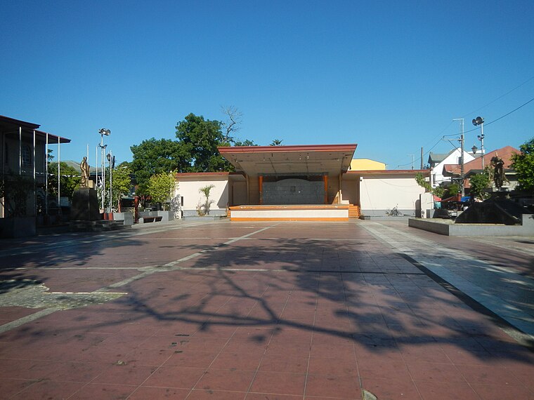
Photo: Judgefloro, CC0.
Morong Plaza is a park, which is situated 1 km northeast of Lexar.
Tomas Claudio historical marker
Memorial
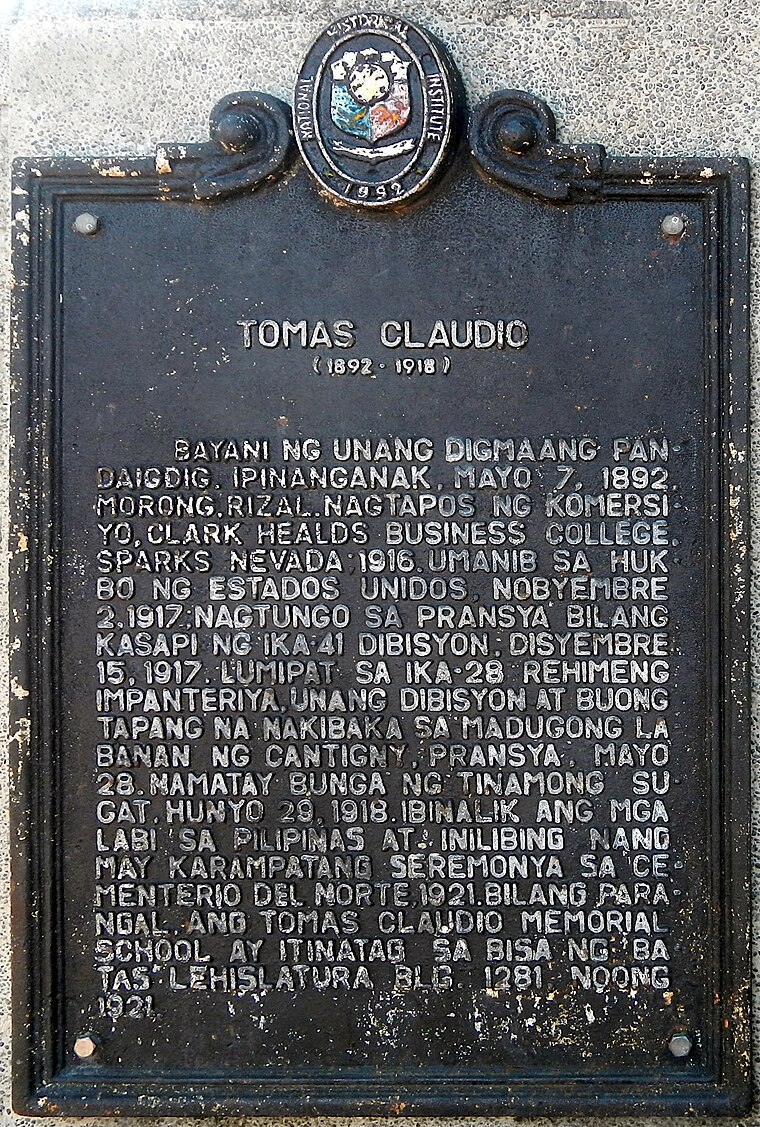
Photo: Judgefloro, CC0.
Tomas Claudio historical marker is a memorial, which is situated 1 km northeast of Lexar.
Morong historical marker
Memorial

Photo: Ramon FVelasquez, CC BY-SA 3.0.
Morong historical marker is a memorial, which is situated 1 km northeast of Lexar.
Places in the Area
Nearby places include Morong and Cardona.
Morong
Town
Photo: Ramon FVelasquez, CC BY-SA 3.0.
Morong, officially the Municipality of Morong, is a municipality located in the province of Rizal, Philippines. As per the 2024 census, Morong has a population of 72,262 people.
Cardona
Town

Photo: Ramon FVelasquez, CC BY-SA 3.0.
Cardona, officially the Municipality of Cardona, is a municipality in the province of Rizal, Philippines. According to the 2024 census, it has a population of 51,493 people.
Baras
Town

Photo: Ramon FVelasquez, CC BY-SA 3.0.
Baras, officially the Municipality of Baras, is a municipality in the province of Rizal, Philippines. According to the 2024 census, it has a population of 91,099 people. Baras is 32 kilometers from Antipolo and 49 kilometers from Manila. Baras is situated 4 km northeast of Lexar.
Lexar
- Type: Commerce
- Address: T. Claudio Street, Morong
- Location: Municipality of Morong, Rizal, Calabarzon, Luzon, Philippines, Southeast Asia, Asia
- View on OpenStreetMap
Latitude
14.50591° or 14° 30′ 21″ northLongitude
121.23511° or 121° 14′ 6″ eastOpen location code
7Q63G64P+92OpenStreetMap ID
way 1135346042OpenStreetMap feature
landuse=commercial
This page is based on OpenStreetMap, Wikidata, and Wikimedia Commons.
We’d love your help improving our open data sources. Thank you for contributing.
Satellite Map
Discover Lexar from above in high-definition satellite imagery.
Notable Places Nearby
Highlights include LTO Morong (District Office) and Morong Municipal Hall.
Nearby Places
Explore places such as Land Transportation Office (LTO) and Total Gas Station.
Rizal: Must-Visit Destinations
Delve into Antipolo, Cainta, Rodriguez, and Angono.
Curious Places to Discover
Uncover intriguing places from every corner of the globe.
About Mapcarta. Data © OpenStreetMap contributors and available under the Open Database License". Text is available under the CC BY-SA 4.0 license, except for photos, directions, and the map. Photo: Wikimedia, CC0.