Ryehill Farm
Ryehill Farm is a farm in Isham, Wellingborough District, England. Ryehill Farm is situated nearby to the forest Big Covert, as well as near Foxhill Spinney.| Tap on a place to explore it |
Places of Interest Nearby
Highlights include Church of All Saints, Pytchley and Harrowden Hall.
Church of All Saints, Pytchley
Church

Photo: Will Lovell, CC BY-SA 2.0.
Church of All Saints, Pytchley is situated 1 mile northwest of Ryehill Farm.
Harrowden Hall
Sports venue
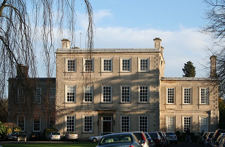
Photo: Wikimedia, CC BY-SA 3.0.
Harrowden Hall is a sports venue, which is situated 2 miles south of Ryehill Farm.
Church of All Saints
Church

Photo: M J Richardson, CC BY-SA 2.0.
Church of All Saints is situated 1½ miles south of Ryehill Farm.
Places in the Area
Nearby places include Great Harrowden and Barton Seagrave.
Great Harrowden
Village
Photo: M J Richardson, CC BY-SA 2.0.
Great Harrowden is a village and civil parish in North Northamptonshire, with a population at the 2011 census of 161. The village is located near the A509 road running between Kettering and Wellingborough. Great Harrowden is situated 2 miles south of Ryehill Farm.
Barton Seagrave
Village
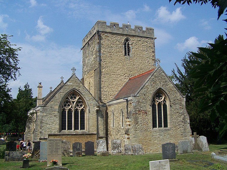
Photo: Geoff Pick, CC BY-SA 2.0.
Barton Seagrave is a large village and civil parish in the North Northamptonshire, England. The village is about 1.5 miles south-east of Kettering, town centre. Barton Seagrave is situated 2 miles northeast of Ryehill Farm.
Hardwick
Village
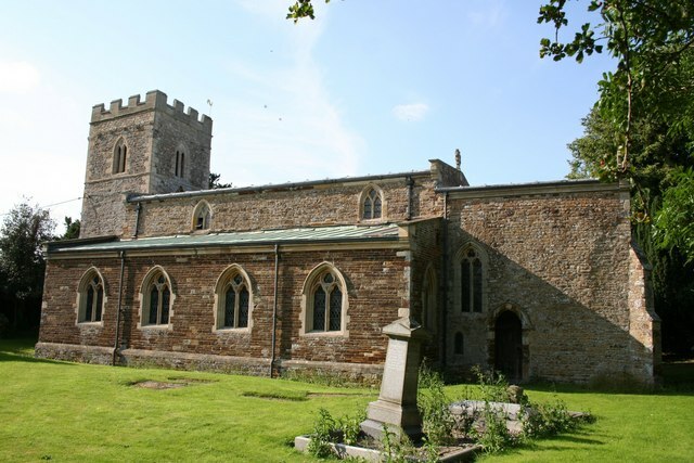
Photo: Richard Croft, CC BY-SA 2.0.
Hardwick is a small village in North Northamptonshire, England, close to the town of Wellingborough. The population is included in the civil parish of Great Harrowden. The village's name means "herd farm". Hardwick is situated 2½ miles southwest of Ryehill Farm.
Ryehill Farm
- Type: Farm
- Category: agriculture
- Location: Isham, Wellingborough District, North Northamptonshire, England, United Kingdom, Britain and Ireland, Europe
- View on OpenStreetMap
Latitude
52.3533° or 52° 21′ 12″ northLongitude
-0.71904° or 0° 43′ 9″ westOpen location code
9C4X973J+89OpenStreetMap ID
way 1145186063OpenStreetMap feature
landuse=farmyard
This page is based on OpenStreetMap, Wikidata, and Wikimedia Commons.
We’d love your help improving our open data sources. Thank you for contributing.
Satellite Map
Discover Ryehill Farm from above in high-definition satellite imagery.
Places with the Same Name
Discover other places named “Ryehill Farm”.
Notable Places Nearby
Highlights include Big Covert and Foxhill Spinney.
Nearby Places
Explore places such as Lodge Farm and Frisby Lodge.
England: Must-Visit Destinations
Delve into London, Manchester, Sheffield, and Leeds.
Curious Farms to Discover
Uncover intriguing farms from every corner of the globe.
About Mapcarta. Data © OpenStreetMap contributors and available under the Open Database License". Text is available under the CC BY-SA 4.0 license, except for photos, directions, and the map. Photo: sidibousaid, CC BY 2.0.