Public Open Space at Buckingham Crescent
Public Open Space at Buckingham Crescent is a park in Stoke-on-Trent, England. Public Open Space at Buckingham Crescent is situated nearby to the park Public Open Space at Sandringham Crescent, as well as near Public Open Space Between 28 & 34 Buckingham Crescent.| Tap on a place to explore it |
Places of Interest Nearby
Highlights include Britannia Stadium and St Joseph’s College, Stoke-on-Trent.
Britannia Stadium
Stadium

Photo: State22, CC BY-SA 3.0.
The bet365 Stadium is an all-seater football stadium in Stoke-on-Trent, Staffordshire, England and the home of EFL Championship club Stoke City. The stadium was previously called the Britannia Stadium but was renamed on 1 June 2016 when the club entered into a new stadium-naming-rights agreement with its parent company, Bet365. Britannia Stadium is situated 1 mile northeast of Public Open Space at Buckingham Crescent.
St Joseph’s College, Stoke-on-Trent
School
St Joseph's College is a coeducational grammar school located in Trent Vale, Stoke on Trent, Staffordshire. The school's oldest and original building in this location is a Grade II listed structure which was previously a residential property before it was bought by the Christian Brothers in 1931. St Joseph’s College, Stoke-on-Trent is situated 3,900 feet northwest of Public Open Space at Buckingham Crescent.
Church of St Mary and All Saints
Church

Photo: Wikimedia, CC BY-SA 2.0.
Church of St Mary and All Saints is situated 1 mile southwest of Public Open Space at Buckingham Crescent.
Places in the Area
Nearby places include Stoke-upon-Trent and Fenton.
Stoke-upon-Trent
Town
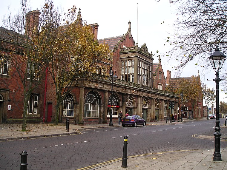
Photo: NoelWalley, CC BY-SA 3.0.
Stoke-upon-Trent, also known as Stoke, is one of the six towns that along with Hanley, Burslem, Fenton, Longton and Tunstall form the city of Stoke-on-Trent, in Staffordshire, England. Stoke-upon-Trent is situated 1½ miles north of Public Open Space at Buckingham Crescent.
Fenton
Town
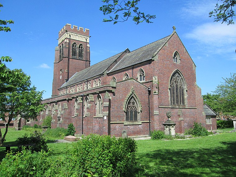
Photo: AtticTapestry, CC BY-SA 4.0.
Fenton is one of the six towns that amalgamated with Hanley, Tunstall, Burslem, Longton and Stoke-upon-Trent to form the county borough of Stoke-on-Trent in 1910, later raised to city status in 1925. Fenton is situated 2 miles northeast of Public Open Space at Buckingham Crescent.
Shelton
Suburb
Shelton is an area of the city of Stoke-on-Trent in Staffordshire, England, between Hanley and Stoke-upon-Trent. Shelton is situated 2½ miles north of Public Open Space at Buckingham Crescent.
Public Open Space at Buckingham Crescent
- Type: Park
- Category: recreation area
- Location: Stoke-on-Trent, England, United Kingdom, Britain and Ireland, Europe
- View on OpenStreetMap
Latitude
52.97896° or 52° 58′ 44″ northLongitude
-2.19214° or 2° 11′ 32″ westOperator
Stoke-on-Trent City CouncilOpen location code
9C4VXRH5+H4OpenStreetMap ID
way 1148578425OpenStreetMap feature
leisure=park
This page is based on OpenStreetMap, Wikidata, and Wikimedia Commons.
We’d love your help improving our open data sources. Thank you for contributing.
Satellite Map
Discover Public Open Space at Buckingham Crescent from above in high-definition satellite imagery.
Notable Places Nearby
Highlights include Public Open Space at Sandringham Crescent and Public Open Space Between 28 & 34 Buckingham Crescent.
Nearby Places
Explore places such as Hanford Manor Residential Home and Premier.
England: Must-Visit Destinations
Delve into London, Manchester, Sheffield, and Leeds.
Curious Parks to Discover
Uncover intriguing parks from every corner of the globe.
About Mapcarta. Data © OpenStreetMap contributors and available under the Open Database License". Text is available under the CC BY-SA 4.0 license, except for photos, directions, and the map. Photo: Leereyno, CC BY-SA 3.0.