Podere Sei Poorte
Podere Sei Poorte is a campsite in Mombaroccio, Pesaro and Urbino, Marche which is located on Via Petricci. Podere Sei Poorte is situated nearby to the winery Il Conventino di Monteciccardo, as well as near the village Sant’Angelo in Lizzola.| Tap on a place to explore it |
- Type: Campsite
- Address: Via Petricci 14, Pesaro, 61122
- Wheelchair access: limited
Places in the Area
Nearby places include Sant’Angelo in Lizzola and Montelabbate.
Sant’Angelo in Lizzola
Village
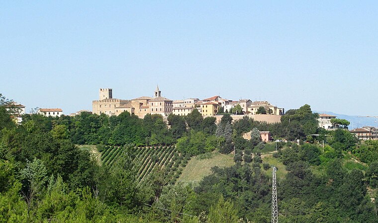
Photo: Toni Pecoraro, Public domain.
Sant'Angelo in Lizzola is a frazione of the comune of Vallefoglia in the province of Pesaro e Urbino in the Italian region Marche. It was a separate comune until 2013. The main parish church is the former collegiate church of San Michele Arcangelo. Sant’Angelo in Lizzola is situated 3½ km northwest of Podere Sei Poorte.
Montelabbate
Village

Photo: Toni Pecoraro, Public domain.
Montelabbate is a comune in the Province of Pesaro e Urbino in the Italian region Marche, located about 60 kilometres northwest of Ancona and about 12 kilometres southwest of Pesaro. Montelabbate is situated 6 km northwest of Podere Sei Poorte.
Serrungarina
Village
Serrungarina is a frazione of the comune of Colli al Metauro in the Province of Pesaro e Urbino in the Italian region Marche, located about 50 kilometres northwest of Ancona and about 20 kilometres south of Pesaro. Serrungarina is situated 7 km southeast of Podere Sei Poorte.
Podere Sei Poorte
- Categories: tourism and camping
- Location: Mombaroccio, Pesaro and Urbino, Marche, Central Italy, Italy, Europe
- View on OpenStreetMap
Latitude
43.80014° or 43° 48′ 1″ northLongitude
12.8211° or 12° 49′ 16″ eastOpen location code
8FMJRR2C+3COpenStreetMap ID
way 115627451OpenStreetMap feature
tourism=camp_siteOpenStreetMap attribute
wheelchair=limited
This page is based on OpenStreetMap, Wikidata, and Wikimedia Commons.
We’d love your help improving our open data sources. Thank you for contributing.
Satellite Map
Discover Podere Sei Poorte from above in high-definition satellite imagery.
Notable Places Nearby
Highlights include Monte Marino and Chiesa del Divino Amore.
Nearby Places
Explore places such as Podere Sei Poorte and Bar SOMS.
Curious Campsites to Discover
Uncover intriguing campsites from every corner of the globe.
About Mapcarta. Data © OpenStreetMap contributors and available under the Open Database License". Text is available under the CC BY-SA 4.0 license, except for photos, directions, and the map. Photo: Wikimedia, CC0.