The Lion’s Diner
The Lion’s Diner is a fast food restaurant in Leeds, England. The Lion’s Diner is situated nearby to the stadium Nethermoor Park, as well as near Guiseley Cricket Club.| Tap on a place to explore it |
Places of Interest Nearby
Highlights include Nethermoor Park and Guiseley railway station.
Nethermoor Park
Stadium

Photo: Super Nintendo Chalmers, CC0.
Nethermoor Park is a football stadium in Guiseley, West Yorkshire and the home ground of Guiseley A.F.C. Opened in 1909, the stadium has a capacity of 4,000.
Guiseley railway station
Railway station
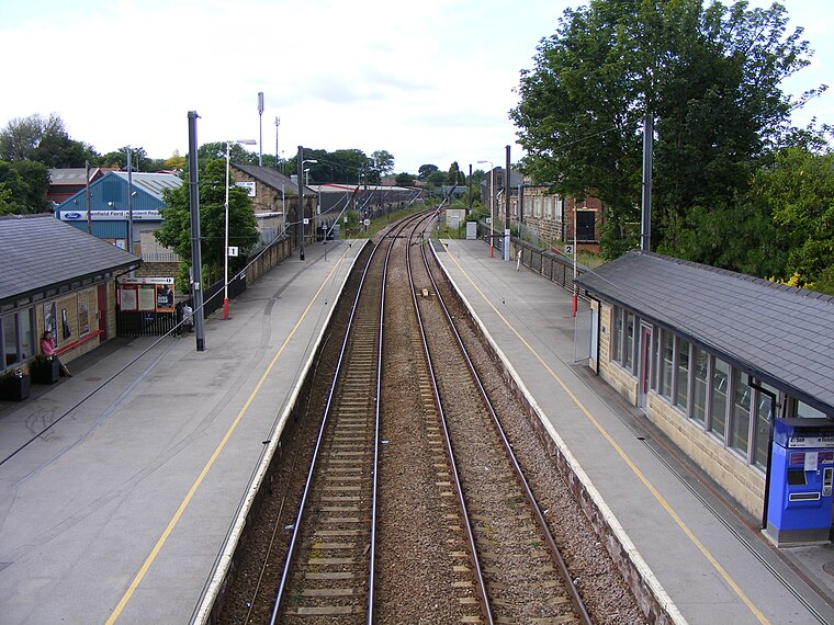
Photo: CrossHouses, CC BY-SA 3.0.
Guiseley railway station serves Guiseley in the City of Leeds metropolitan borough, West Yorkshire, England. On the Wharfedale Line between Ilkley and Leeds/Bradford Forster Square, it is served mostly by Class 333 electric trains run by Northern Trains, which also manages the station. Guiseley railway station is situated 1,000 feet southeast of The Lion’s Diner.
Guiseley Theatre
Theater building

Photo: John Slater, CC BY-SA 2.0.
Guiseley Theatre, formerly Guiseley Town Hall, is a municipal building at The Green, Guiseley, West Yorkshire, England. The structure, which was once the headquarters of Guiseley Urban District Council, is now a theatre. Guiseley Theatre is situated 3,300 feet southeast of The Lion’s Diner.
Places in the Area
Nearby places include Guiseley and Hawksworth.
Guiseley
Town

Photo: Mtaylor848, CC BY-SA 3.0.
Guiseley is a small town in the metropolitan borough of the City of Leeds, West Yorkshire, England. Historically part of the West Riding of Yorkshire, it is situated south of Otley and Menston and is now a north-western suburb of Leeds.
Hawksworth
Village

Photo: Joe Regan, CC BY-SA 2.0.
Hawksworth is a village 1 mile west of the town of Guiseley in West Yorkshire, England. It is located to the south of Menston and north of Baildon.
Esholt
Village
 Esholt is a village and former civil parish in the metropolitan district of the City of Bradford, West Yorkshire, England. It is situated 3 miles east of Shipley town centre, 1.5 miles south-west of the A65 in Guiseley, 7 miles north of Bradford City Centre, and 10 miles north-west of Millennium Square, Leeds.
The Lion’s Diner
- Type: Fast food restaurant
- Categories: building, kiosk, food, and restaurant
- Location: Leeds, England, United Kingdom, Britain and Ireland, Europe
- View on OpenStreetMap
Latitude
53.87771° or 53° 52′ 40″ northLongitude
-1.71905° or 1° 43′ 9″ westOpen location code
9C5WV7HJ+39OpenStreetMap ID
way 1157444703OpenStreetMap feature
amenity=fast_foodOpenStreetMap feature
building=kiosk
This page is based on OpenStreetMap, Wikidata, and Wikimedia Commons.
We’d love your help improving our open data sources. Thank you for contributing.
Satellite Map
Discover The Lion’s Diner from above in high-definition satellite imagery.
Notable Places Nearby
Highlights include Guiseley Cricket Club and Guiseley Association Football Club.
Nearby Places
Explore places such as Netherfield Road Car Park and Crompton Parkinson clock tower.
England: Must-Visit Destinations
Delve into London, Manchester, Sheffield, and Leeds.
Curious Fast Food Restaurants to Discover
Uncover intriguing fast food restaurants from every corner of the globe.
About Mapcarta. Data © OpenStreetMap contributors and available under the Open Database License". Text is available under the CC BY-SA 4.0 license, except for photos, directions, and the map. Photo: sidibousaid, CC BY 2.0.