Cranford Park Project
Cranford Park Project is in Greater London, England. Cranford Park Project is situated nearby to Cranford House Stables, as well as near Church of St Dunstan.| Tap on a place to explore it |
Places of Interest Nearby
Highlights include Church of St Dunstan and Hayes & Harlington railway station.

Hayes & Harlington railway station
Railway station
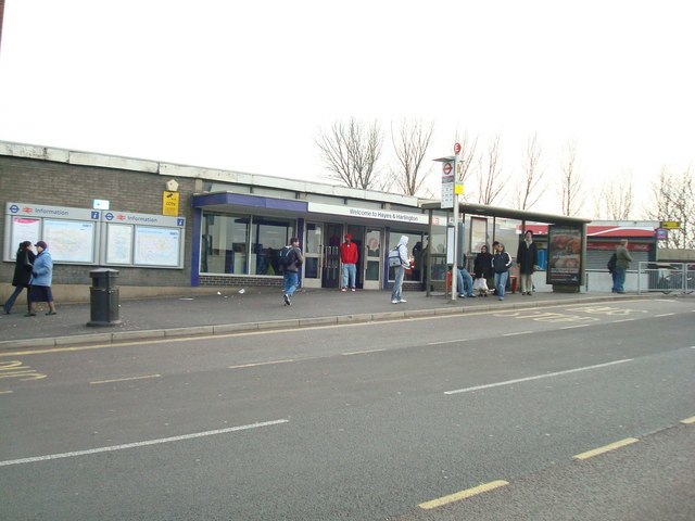
Photo: Stacey Harris, CC BY-SA 2.0.
Hayes & Harlington is a railway station serving the west London districts Hayes and Harlington in the London Borough of Hillingdon. It is 10 miles 71 chains down the line from London Paddington and is situated between Southall and West Drayton. Hayes & Harlington railway station is situated 4,100 feet north of Cranford Park Project.
Cranford Community College
School
Cranford Community College is a secondary school with academy status in the London Borough of Hounslow, England. Cranford Community College is situated 2,300 feet southeast of Cranford Park Project.
Places in the Area
Nearby places include West London and Cranford.
West London

Photo: brett jordan, CC BY 2.0.
The outer western suburbs of Greater London form a diverse area that ranges from the densely-populated but tree-lined streets of Chiswick, Acton and Ealing, through to the semi-rural western districts that lie between Heathrow Airport and Uxbridge.
Cranford
Suburb

Photo: David Hawgood, CC BY-SA 2.0.
Cranford is a suburban area straddling the London Boroughs of Hillingdon and Hounslow. It is located 12.5 miles west of Charing Cross and immediately east of Heathrow Airport, from which it is separated by the River Crane.
Harlington
Village

Photo: Rodolph, CC BY-SA 3.0.
Harlington is a district of Hayes in the London Borough of Hillingdon and one of five historic parishes partly developed into London Heathrow Airport and associated businesses, the one most heavily developed being Harmondsworth.
Cranford Park Project
- Type: Construction
- Location: Greater London, England, United Kingdom, Britain and Ireland, Europe
- View on OpenStreetMap
Latitude
51.49181° or 51° 29′ 31″ northLongitude
-0.41532° or 0° 24′ 55″ westOpen location code
9C3XFHRM+PVOpenStreetMap ID
way 1170353598OpenStreetMap feature
landuse=construction
This page is based on OpenStreetMap, Wikidata, and Wikimedia Commons.
We’d love your help improving our open data sources. Thank you for contributing.
Satellite Map
Discover Cranford Park Project from above in high-definition satellite imagery.
Notable Places Nearby
Highlights include Cranford House Stables and Cranford Country Park.
Nearby Places
Explore places such as Cranford Park Visitor Centre and Hail & Ride Carfax Road.
England: Must-Visit Destinations
Delve into London, Manchester, Sheffield, and Leeds.
Curious Places to Discover
Uncover intriguing places from every corner of the globe.
About Mapcarta. Data © OpenStreetMap contributors and available under the Open Database License". Text is available under the CC BY-SA 4.0 license, except for photos, directions, and the map. Photo: sidibousaid, CC BY 2.0.