Station d’épuration de Mettet
Station d’épuration de Mettet is a wastewater treatment plant in Mettet, Arrondissement of Namur, Wallonia. Station d’épuration de Mettet is situated nearby to the hamlet Scry, as well as near the archaeological site Domaine Gallo-Romain de Bauselenne.| Tap on a place to explore it |
Places in the Area
Nearby places include Scry and Biesme.
Biesme
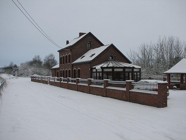
Village

Photo: Jean-Pol GRANDMONT, CC BY 2.5.
Biesme is a village of Wallonia and a district of the municipality of Mettet, located in the province of Namur, Belgium.
Furnaux
Village

Photo: Jean-Pol GRANDMONT, CC BY-SA 3.0.
Furnaux is a village of Wallonia and a district of the municipality of Mettet, located in the province of Namur, Belgium. The discovery of remains from Roman times in Furnaux indicates that the village has been inhabited since at least the first century AD. Furnaux is situated 5 km southeast of Station d’épuration de Mettet.
Station d’épuration de Mettet
- Type: Wastewater treatment plant
- Category: industry
- Location: Mettet, Arrondissement of Namur, Namur, Wallonia, Belgium, Benelux, Europe
- View on OpenStreetMap
Latitude
50.33123° or 50° 19′ 52″ northLongitude
4.63946° or 4° 38′ 22″ eastOpen location code
9F268JJQ+FQOpenStreetMap ID
way 117201541OpenStreetMap feature
man_made=wastewater_plant
This page is based on OpenStreetMap, Wikidata, and Wikimedia Commons.
We’d love your help improving our open data sources. Thank you for contributing.
Satellite Map
Discover Station d’épuration de Mettet from above in high-definition satellite imagery.
Notable Places Nearby
Highlights include Domaine Gallo-Romain de Bauselenne and Château de Scry.
Nearby Places
Explore places such as Potale Notre-Dame de Lourdes and Ferme de Montigny.
Curious Wastewater Treatment Plants to Discover
Uncover intriguing wastewater treatment plants from every corner of the globe.
About Mapcarta. Data © OpenStreetMap contributors and available under the Open Database License". Text is available under the CC BY-SA 4.0 license, except for photos, directions, and the map. Photo: Zairon, CC BY-SA 4.0.