Dolc-Elit
Dolc-Elit is a building in Salorno sulla strada del vino/Salurn an der Weinstraße, South Tyrol, Trentino-Alto Adige which is located on Via Nazionale - Staatsstraße. Dolc-Elit is situated nearby to the fire station Vigili del Fuoco Volontari Salorno - Freiwillige Feuerwehr Salurn, as well as near the building House ‘of the Rose’.| Tap on a place to explore it |
Places of Interest Nearby
Highlights include Church of St. Joseph and Salorno/Salurn railway station.
Church of St. Joseph
Church

Photo: ManfredK, CC BY-SA 4.0.
Church of St. Joseph is situated 390 metres southeast of Dolc-Elit.
Salorno/Salurn railway station
Railway station
 Salorno/Salurn railway station is situated 710 metres north of Dolc-Elit.
Haderburg
Ruins

Photo: Maschär, CC BY-SA 3.0.
Haderburg is a ruins, which is situated 480 metres south of Dolc-Elit.
Places in the Area
Nearby places include Salorno and Roveré della Luna.
Salorno
Village

Photo: Richard Huber, CC BY-SA 3.0.
Salorno sulla Strada del Vino is the southernmost comune and a village in South Tyrol in northern Italy, located about 30 kilometres southwest of the city of Bolzano. It is one of only six mainly Italian-speaking municipalities in South Tyrol.
Roveré della Luna
Village
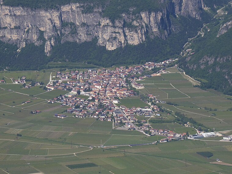
Photo: Syrio, CC BY-SA 4.0.
Roveré della Luna is a comune in Trentino in the northern Italian region Trentino-Alto Adige/Südtirol, located about 20 kilometres north of Trento. Roveré della Luna borders the following municipalities: Kurtatsch, Vervò, Margreid, Ton, Salorno and Mezzocorona. Roveré della Luna is situated 3 km northwest of Dolc-Elit.
Buchholz
Village

Photo: Syrio, CC BY-SA 4.0.
Buchholz is a village, which is situated 3 km east of Dolc-Elit.
Dolc-Elit
- Type: Building
- Address: Via Nazionale - Staatsstraße 44, Salorno - Salurn, 39040
- Location: Salorno sulla strada del vino/Salurn an der Weinstraße, South Tyrol, Trentino-Alto Adige, Northeast Italy, Italy, Europe
- View on OpenStreetMap
Latitude
46.23958° or 46° 14′ 23″ northLongitude
11.20553° or 11° 12′ 20″ eastOpen location code
8FRH66Q4+R6OpenStreetMap ID
way 117386912OpenStreetMap feature
building=yes
This page is based on OpenStreetMap, Wikidata, and Wikimedia Commons.
We’d love your help improving our open data sources. Thank you for contributing.
Satellite Map
Discover Dolc-Elit from above in high-definition satellite imagery.
Notable Places Nearby
Highlights include Vigili del Fuoco Volontari Salorno - Freiwillige Feuerwehr Salurn and House ‘of the Rose’.
Nearby Places
Explore places such as Calzature Due Leoni Schuhwaren and Zona Produttiva Ischia Nord - Gewerbezone In der Au Nord.
South Tyrol: Must-Visit Destinations
Delve into Bolzano, Brixen, Merano, and Bruneck.
Curious Buildings to Discover
Uncover intriguing buildings from every corner of the globe.
About Mapcarta. Data © OpenStreetMap contributors and available under the Open Database License". Text is available under the CC BY-SA 4.0 license, except for photos, directions, and the map. Photo: Benreis, CC BY 3.0.