Marine Management Organisation
Marine Management Organisation is an office in Adur District, West Sussex, England which is located on Basin Road South. Marine Management Organisation is situated nearby to Adur Dry Dock, as well as near Southwick Marina.| Tap on a place to explore it |
- Type: Office
- Address: Basin Road South, Brighton, BN41 1WD
- Roof shape: gabled
Places of Interest Nearby
Highlights include Southwick railway station and Shoreham Power Station.
Southwick railway station
Railway station
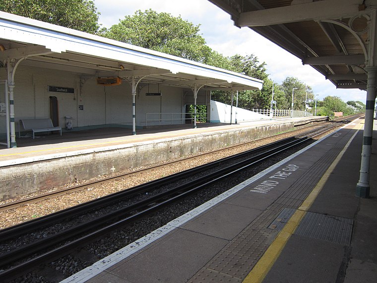
Photo: My another account, CC0.
Southwick railway station serves the town of Southwick in West Sussex, England. It is on the West Coastway Line, 4 miles 30 chains from Brighton. It is operated by Southern. Its platforms are long enough for eight-coach trains. Southwick railway station is situated 1,300 feet north of Marine Management Organisation.
Shoreham Power Station
Power station

Photo: OLU, CC BY-SA 2.0.
Shoreham Power Station is a 420MWe combined cycle gas-fired power station in Southwick, West Sussex. It was built on the site of the Shoreham B Power Station. Shoreham Power Station is situated 1,700 feet east of Marine Management Organisation.
Kingston Lighthouse
Lighthouse

Photo: Bob Embleton, CC BY-SA 2.0.
Kingston by Sea, also known as Kingston Buci, Kingston Bucii or simply Kingston, is a small area in the Adur district of West Sussex, England. Although it is now part of a continuous urban area, its origins lay in an ancient village and parish church between…
Places in the Area
Nearby places include Southwick and Kingston by Sea.
Southwick
Town

Photo: The Voice of Hassocks, Public domain.
Southwick is a town in the Adur district of West Sussex, England located five miles west of Brighton. It covers an area of 863.7 ha. In 2001 it had a population of 13,195.
Kingston by Sea
Village

Photo: Simon Carey, CC BY-SA 2.0.
Kingston by Sea, also known as Kingston Buci, Kingston Bucii or simply Kingston, is a small area in the Adur district of West Sussex, England. Although it is now part of a continuous urban area, its origins lay in an ancient village and parish church between…
Portslade
Town

Photo: The Voice of Hassocks, Public domain.
Portslade is a western suburb of the city of Brighton and Hove in the ceremonial county of East Sussex, England. Portslade Village, the original settlement a mile inland to the north, was built up in the 16th century.
Marine Management Organisation
- Category: building
- Location: Adur District, West Sussex, South East England, England, United Kingdom, Britain and Ireland, Europe
- View on OpenStreetMap
Latitude
50.82897° or 50° 49′ 44″ northLongitude
-0.23777° or 0° 14′ 16″ westLevels
1Height
20 feet (6 metres)Open location code
9C2XRQH6+HVOpenStreetMap ID
way 1178584093OpenStreetMap feature
building=yesOpenStreetMap feature
office=yesOpenStreetMap attribute
roof-shape=gabled
This page is based on OpenStreetMap, Wikidata, and Wikimedia Commons.
We’d love your help improving our open data sources. Thank you for contributing.
Satellite Map
Discover Marine Management Organisation from above in high-definition satellite imagery.
Notable Places Nearby
Highlights include Adur Dry Dock and Southwick Marina.
Nearby Places
Explore places such as Carats Cafe Bar and Prince George Lock.
West Sussex: Must-Visit Destinations
Delve into Chichester, Crawley, Worthing, and Horsham.
Curious Offices to Discover
Uncover intriguing offices from every corner of the globe.
About Mapcarta. Data © OpenStreetMap contributors and available under the Open Database License". Text is available under the CC BY-SA 4.0 license, except for photos, directions, and the map. Photo: wildlife encounters, CC BY 2.0.