Rinder-Union-West eG
Rinder-Union-West eG is a farm in Kleve, Düsseldorf, North Rhine-Westphalia. Rinder-Union-West eG is situated nearby to the building Haus Schmithausen, as well as near the church Alte Kirche (Kellen).| Tap on a place to explore it |
Places of Interest Nearby
Highlights include Haus Schmithausen and Alte Kirche (Kellen).
Haus Schmithausen
Building

Photo: Pelikana, CC BY-SA 4.0.
Haus Schmithausen is a building, which is situated 140 metres north of Rinder-Union-West eG.
Alte Kirche (Kellen)
Church

Photo: Wolfgang0802, CC BY-SA 3.0.
Alte Kirche (Kellen) is a church, which is situated 570 metres southwest of Rinder-Union-West eG.
Konrad-Adenauer-Gymnasium
School

Photo: Kadenauerd, CC BY-SA 4.0.
Konrad-Adenauer-Gymnasium is a school, which is situated 1 km west of Rinder-Union-West eG.
Places in the Area
Nearby places include Griethausen and Qualburg.
Griethausen
Village
Griethausen is a village and former city in the municipality of Kleve, Kreis Kleve in the German State of North Rhine-Westphalia. The village is located at the Griethauser Altrhein. Griethausen is situated 2½ km north of Rinder-Union-West eG.
Qualburg
Village
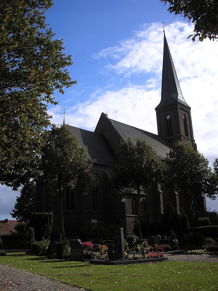
Photo: MiraculixHB, Public domain.
Qualburg is a village, which is situated 3 km south of Rinder-Union-West eG.
Rindern
Village
Rindern is a village in the Kleve of Lower Rhine region of Germany. It is part of the town Kleve. Rindern is situated 3½ km west of Rinder-Union-West eG.
Rinder-Union-West eG
- Type: Farm
- Category: agriculture
- Location: Kleve, Kleve, Düsseldorf, Lower Rhine, North Rhine-Westphalia, Germany, Central Europe, Europe
- View on OpenStreetMap
Latitude
51.8014° or 51° 48′ 5″ northLongitude
6.17382° or 6° 10′ 26″ eastOpen location code
9F38R52F+HGOpenStreetMap ID
way 119381755OpenStreetMap feature
landuse=farmyard
This page is based on OpenStreetMap, Wikidata, and Wikimedia Commons.
We’d love your help improving our open data sources. Thank you for contributing.
Satellite Map
Discover Rinder-Union-West eG from above in high-definition satellite imagery.
Notable Places Nearby
Highlights include Spielplatz Gildeweg and Kellener Schuetzenverein e.V..
Nearby Places
Explore places such as Euregio and Euregio.
Lower Rhine: Must-Visit Destinations
Delve into Düsseldorf, Mönchengladbach, Krefeld, and Neuss.
Curious Farms to Discover
Uncover intriguing farms from every corner of the globe.
About Mapcarta. Data © OpenStreetMap contributors and available under the Open Database License". Text is available under the CC BY-SA 4.0 license, except for photos, directions, and the map. Photo: Orange2000, CC BY-SA 4.0.