Fantasyland Operations
Fantasyland Operations is an office in Orange County, Southern California, California. Fantasyland Operations is situated nearby to the fast food restaurant Red Rose Taverne, as well as near the peak Big Thunder Mountain.| Tap on a place to explore it |
Places of Interest Nearby
Highlights include Disneyland and Peter Pan’s Flight.
Disneyland

Photo: Wikimedia, CC BY-SA 3.0.
The Disneyland Resort is a theme park complex in Anaheim, California. It is home to the original Disneyland Park, which has been a favorite among Los Angeles residents and visitors to Southern California from all over the world since it opened in 1955.
Peter Pan’s Flight
Dark ride

Photo: Carterhawk, CC BY-SA 3.0.
Peter Pan's Flight is a rail-suspended dark ride at the Disneyland, Magic Kingdom, Tokyo Disneyland, Disneyland Park and Shanghai Disneyland theme parks.
Casey Jr. Circus Train
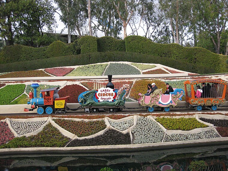
Photo: Bytebear, CC BY-SA 4.0.
The Casey Jr. Circus Train is the name of a ridable railroad attraction found at Disneyland and a powered roller coaster attraction found at Disneyland Park.
Places in the Area
Nearby places include Frontierland at Disneyland and Tom Sawyer Island.
Frontierland at Disneyland
Locality

Photo: Boris Dzhingarov, CC BY 2.0.
Frontierland at Disneyland is a locality.
Tom Sawyer Island
Locality

Photo: Boris Dzhingarov, CC BY 2.0.
Tom Sawyer Island is an artificial island surrounded by the Rivers of America at Disneyland and Tokyo Disneyland. It contains structures and caves with references to Mark Twain characters from the novel The Adventures of Tom Sawyer, and provides interactive, climbing, and scenic opportunities.

Fantasyland Operations
- Type: Office
- Location: Orange County, Southern California, California, United States, North America
- View on OpenStreetMap
Latitude
33.81323° or 33° 48′ 48″ northLongitude
-117.91971° or 117° 55′ 11″ westOpen location code
8554R37J+74OpenStreetMap ID
way 1195943999OpenStreetMap feature
office=yes
This page is based on OpenStreetMap, Wikidata, and Wikimedia Commons.
We’d love your help improving our open data sources. Thank you for contributing.
Satellite Map
Discover Fantasyland Operations from above in high-definition satellite imagery.
Notable Places Nearby
Highlights include Red Rose Taverne and Big Thunder Mountain.
Nearby Places
Explore places such as Tinkerbell Landing Platform and Big Thunder Mountain Show Building.
Orange County: Must-Visit Destinations
Delve into Disneyland, Anaheim, Santa Ana, and Irvine.
Curious Offices to Discover
Uncover intriguing offices from every corner of the globe.
About Mapcarta. Data © OpenStreetMap contributors and available under the Open Database License". Text is available under the CC BY-SA 4.0 license, except for photos, directions, and the map. Photo: Traveler100, CC BY-SA 3.0.