Corona Tower
Corona Tower is a residential area in Central and Western District, Hong Kong which is located on 堅道 Caine Road. Corona Tower is situated nearby to 香港浸信教會恩典樓 House Of Grace, Hong Kong Bapist Church, as well as near Kwong Hon Terrace Garden.| Tap on a place to explore it |
Places of Interest Nearby
Highlights include Dr Sun Yat-sen Museum and Kwong Hon Terrace Garden.
Dr Sun Yat-sen Museum
Museum

Photo: Tong Kam Semo, CC BY-SA 3.0.
The Dr Sun Yat-sen Museum is a museum in Central, Hong Kong. It is located in Kom Tong Hall, at 7 Castle Road, Central. After preparatory work undertaken by the Hong Kong Museum of History, the museum opened to the public on 12 December 2006 to commemorate the 140th birthday of the influential Chinese statesman Sun Yat-sen.

Jamia Mosque
Mosque
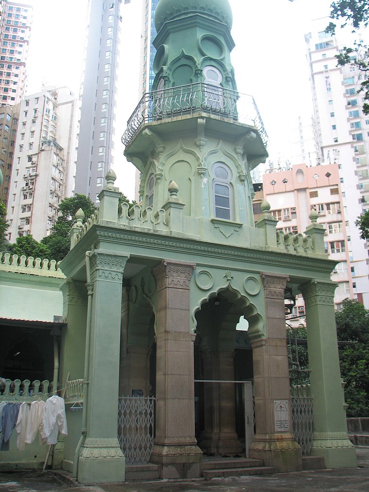
Photo: Lookchard, Public domain.
The Jamia Mosque is a Friday mosque in Mid-Levels, Hong Kong, China. Completed in 1890, it is the oldest mosque in Hong Kong. The neighbouring streets – Mosque Street and Mosque Junction – are named after the mosque. Jamia Mosque is situated 220 metres south of Corona Tower.
Places in the Area
Nearby places include SoHo and Sheung Wan.
SoHo
Neighborhood

Photo: Rilsluioa, CC BY-SA 3.0.
SoHo is an area of Hong Kong located on the western edge of Central, bordering Sheung Wan, known for its bars, restaurants and entertainment venues. The name is derived from its location: South of Hollywood Road.
Sheung Wan
Suburb

Photo: WIBEAN, CC BY-SA 2.5.
Sheung Wan is an area in Hong Kong, located in the north-west of Hong Kong Island, between Central and Sai Ying Pun. Administratively, it is part of the Central and Western District. The name can be variously interpreted as Upper District, or Gateway District.
Central Hong Kong

Photo: seeminglee, CC BY 2.0.
Central and Western is a district of Hong Kong Island. It is the political, administrative and financial hub and home to some fantastic skyscrapers and Victoria Peak.
Corona Tower
- Type: Residential area
- Address: 93 堅道 Caine Road
- Location: Central and Western District, Hong Kong, East Asia, Asia
- View on OpenStreetMap
Latitude
22.28208° or 22° 16′ 56″ northLongitude
114.15166° or 114° 9′ 6″ eastOpen location code
7PJP75J2+RMOpenStreetMap ID
way 1202611409OpenStreetMap feature
landuse=residential
This page is based on OpenStreetMap, Wikidata, and Wikimedia Commons.
We’d love your help improving our open data sources. Thank you for contributing.
Satellite Map
Discover Corona Tower from above in high-definition satellite imagery.
In Other Languages
“Corona Tower” goes by many names.
- Chinese: “嘉景臺”
Notable Places Nearby
Highlights include 香港浸信教會恩典樓 House Of Grace, Hong Kong Bapist Church and Chung Wo Lane Sitting-out Area.
Nearby Places
Explore places such as 7-Eleven and Ying Pont Building.
Hong Kong: Must-Visit Destinations
Delve into Kowloon, Hong Kong International Airport, Outlying Islands, and Central Hong Kong.
Curious Residential Areas to Discover
Uncover intriguing residential areas from every corner of the globe.
About Mapcarta. Data © OpenStreetMap contributors and available under the Open Database License". Text is available under the CC BY-SA 4.0 license, except for photos, directions, and the map. Photo: seeminglee, CC BY 2.0.