Nursery St Pocket Park
Nursery St Pocket Park is a park in Sheffield, England. Nursery St Pocket Park is situated nearby to New Testament Church of God, as well as near the community center Family Life Centre.| Tap on a place to explore it |
Places of Interest Nearby
Highlights include Crucible Theatre and Lady’s Bridge.
Crucible Theatre
Theater building

Photo: Chris Downer, CC BY-SA 2.0.
The Crucible Theatre, or simply The Crucible, is a theatre in Sheffield, South Yorkshire, England, which opened in 1971. Its name refers to crucible steel, which was developed in Sheffield in 1740 and drove the industrialisation of the city. Crucible Theatre is situated 2,200 feet south of Nursery St Pocket Park.
Lady’s Bridge
Bridge

Photo: N Chadwick, CC BY-SA 2.0.
Lady's Bridge is the oldest bridge across the River Don in the City of Sheffield, England. It is located in the central section of the city, linking the Wicker to the north with Waingate to the south. Lady’s Bridge is situated 540 feet south of Nursery St Pocket Park.
Sheffield Cathedral
Church
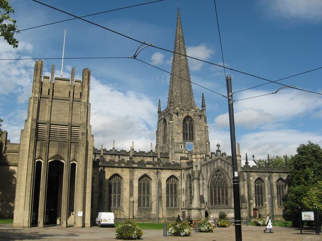
Photo: Richard Rogerson, CC BY-SA 2.0.
The Cathedral Church of St Peter and St Paul, Sheffield, also known as Sheffield Cathedral, is the cathedral church for the Church of England diocese of Sheffield, England. Sheffield Cathedral is situated 1,700 feet southwest of Nursery St Pocket Park.
Places in the Area
Nearby places include Riverside Quarter and Castlegate Quarter.
Riverside Quarter
Quarter
The Riverside Quarter, or Riverside Exchange is one of Sheffield's 11 designated City Centre Quarters. Its borders are West Bar, Coulston Street, Bridge Street, Castlegate, Exchange Place and the Parkway to its south, the Wicker Viaduct, Johnson Street, Spitalfields and Nursery Street to the North, and Corporation Street to the west.
Castlegate Quarter
Quarter
The Castlegate Quarter is one of the eleven quarters of Sheffield city centre. It is named after Castlegate, the quarter's main thoroughfare. The boundaries of the Castlegate Quarter are formed by Castlegate and the River Don to the north, Exchange Place to the east, Commercial Street and part of the High Street to the south, and Angel Street and Snig Hill to the west.
Cathedral Quarter
Quarter
The Cathedral Quarter is one of Sheffield's eleven designated quarters, located around and named after the Cathedral. It is bound by Tenter Street to the Northwest, West Bar to the North, Snig Hill to the North east, Angel Street to the East, High Street and Church Street to the south and Townhead Street around its western corner.
Nursery St Pocket Park
- Type: Park
- Category: recreation area
- Location: Sheffield, England, United Kingdom, Britain and Ireland, Europe
- View on OpenStreetMap
Latitude
53.387° or 53° 23′ 13″ northLongitude
-1.4652° or 1° 27′ 55″ westOpen location code
9C5W9GPM+QWOpenStreetMap ID
way 1211124714OpenStreetMap feature
leisure=park
This page is based on OpenStreetMap, Wikidata, and Wikimedia Commons.
We’d love your help improving our open data sources. Thank you for contributing.
Satellite Map
Discover Nursery St Pocket Park from above in high-definition satellite imagery.
Notable Places Nearby
Highlights include New Testament Church of God and Family Life Centre.
Nearby Places
Explore places such as Nursery Street/Johnson Street and Texmo.
England: Must-Visit Destinations
Delve into London, Manchester, Leeds, and York.
Curious Parks to Discover
Uncover intriguing parks from every corner of the globe.
About Mapcarta. Data © OpenStreetMap contributors and available under the Open Database License". Text is available under the CC BY-SA 4.0 license, except for photos, directions, and the map. Photo: sidibousaid, CC BY 2.0.