Foss Beckwith
Foss Beckwith is an electrical substation in York, England. Foss Beckwith is situated nearby to the health club The Gym Group, as well as near Swift Fitness.| Tap on a place to explore it |
Places of Interest Nearby
Highlights include York Minster and Red Tower.
York Minster
Church
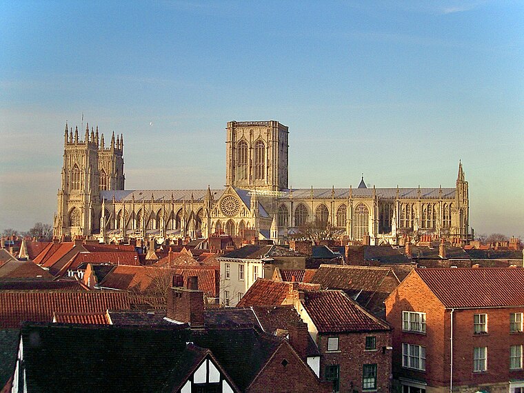
Photo: MatzeTrier, CC BY-SA 3.0.
York Minster, formally the Cathedral and Metropolitical Church of Saint Peter in York, is an Anglican cathedral in the city of York, North Yorkshire, England. York Minster is situated 2,200 feet west of Foss Beckwith.
Red Tower
Community center

Photo: HJ Mitchell, CC BY 3.0.
The Red Tower is a medieval tower that formed part of the city defences of York, England. It is located on the city walls at Foss Islands Road, on the stretch of wall north of Walmgate Bar and is the only brick tower in the city. Red Tower is situated 1,200 feet south of Foss Beckwith.
Jorvik Viking Centre
Museum
Photo: CambridgeBayWeather, CC BY 2.5.
Jorvik Viking Centre is a museum and visitor attraction in York, England, containing lifelike mannequins and life-size dioramas depicting Viking life in the city. Jorvik Viking Centre is situated 2,300 feet southwest of Foss Beckwith.
Places in the Area
Nearby places include Layerthorpe and York.
Layerthorpe
Suburb
Layerthorpe is a part of the city of York in, North Yorkshire, England. It is outside the city walls of York. The road through Layerthorpe from the bridge over the River Foss to Heworth is also shares the same name.
York

Photo: robbophotos, CC BY 2.0.
The ancient cathedral city of York has a history dating back over 2000 years. Romans, Saxons, Vikings, and Britons from all eras have each left their mark.
The Groves
Neighborhood

Photo: Ian S, CC BY-SA 2.0.
The Groves is a district of York, England, covering the area just north of the city centre between Huntington Road and Haxby Road. The district is near York Hospital and the city ring road.
Foss Beckwith
- Type: Electrical substation
- Categories: building and industry
- Location: York, England, United Kingdom, Britain and Ireland, Europe
- View on OpenStreetMap
Latitude
53.96111° or 53° 57′ 40″ northLongitude
-1.07191° or 1° 4′ 19″ westOperator
Northern PowergridOpen location code
9C5WXW6H+C6OpenStreetMap ID
way 1211657776OpenStreetMap feature
building=yes
This page is based on OpenStreetMap, Wikidata, and Wikimedia Commons.
We’d love your help improving our open data sources. Thank you for contributing.
Satellite Map
Discover Foss Beckwith from above in high-definition satellite imagery.
Notable Places Nearby
Highlights include The Gym Group and Swift Fitness.
Nearby Places
Explore places such as Foss Islands and Urbanite student accommodation.
England: Must-Visit Destinations
Delve into London, Manchester, Sheffield, and Leeds.
Curious Electrical Substations to Discover
Uncover intriguing electrical substations from every corner of the globe.
About Mapcarta. Data © OpenStreetMap contributors and available under the Open Database License". Text is available under the CC BY-SA 4.0 license, except for photos, directions, and the map. Photo: sidibousaid, CC BY 2.0.