Atico Hair Emporium
Atico Hair Emporium is a hairdresser in Wigan, England which is located on St Helens Road. Atico Hair Emporium is situated nearby to Leigh Bridge, as well as near Christ Church.| Tap on a place to explore it |
Places of Interest Nearby
Highlights include Christ Church and The Progress With Unity Stadium.
Christ Church
Church
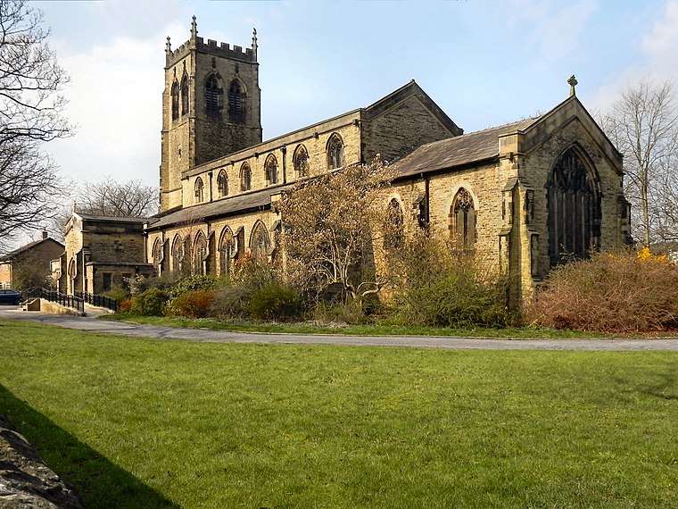
Photo: Wikimedia, CC BY-SA 2.0.
Christ Church is an active Anglican parish church in Pennington, Leigh, Greater Manchester, England. Christ Church serves the parish of Pennington in the Leigh Deanery and Salford Archdeaconry in the Diocese of Manchester. It is a Grade II listed building. Christ Church is situated 610 feet southwest of Atico Hair Emporium.
The Progress With Unity Stadium
Stadium

Photo: Dave Green, CC BY-SA 2.0.
The Progress With Unity Stadium, is a multi-use sports, retail and housing development in Leigh, Greater Manchester, England. The centrepiece of the development is a 12,000-capacity stadium which is home to professional rugby league team Leigh Leopards, the Manchester United Women's senior team, and Manchester United's men's Under-21 and Academy teams. The Progress With Unity Stadium is situated 2,200 feet southwest of Atico Hair Emporium.
Leigh bus station
Bus station

Photo: ray blow, CC BY-SA 2.0.
Leigh is a town in Greater Manchester, England, on low-lying land northwest of Chat Moss. Within the boundaries of the historic county of Lancashire, Leigh was originally the centre of a large ecclesiastical parish covering six vills or townships. Leigh bus station is situated 1,200 feet northeast of Atico Hair Emporium.
Places in the Area
Nearby places include Leigh and Bedford.
Leigh
Town

Photo: Chris Allen, CC BY-SA 2.0.
Leigh is a town in Greater Manchester, England, on low-lying land northwest of Chat Moss. Within the boundaries of the historic county of Lancashire, Leigh was originally the centre of a large ecclesiastical parish covering six vills or townships.
Bedford
Suburb
Bedford is a suburb of Leigh, in the Wigan district, in the county of Greater Manchester, England. It was one of three ancient townships, Bedford, Pennington and Westleigh, that merged in 1875 to form the town of Leigh. Historically, Bedford was in Lancashire.
Atherton
Town

Photo: Wikimedia, CC BY-SA 2.0.
Atherton is a town in the Metropolitan Borough of Wigan in Greater Manchester, England and historically part of Lancashire. The town, including Hindsford, Howe Bridge and Hag Fold, is five miles south of Bolton, seven miles east of Wigan, and 10 miles northwest of Manchester. Atherton is situated 2½ miles northeast of Atico Hair Emporium.
Atico Hair Emporium
- Type: Hairdresser
- Address: 38 St Helens Road, Leigh, WN7 4HW
- Categories: building and shop
- Location: Wigan, England, United Kingdom, Britain and Ireland, Europe
- View on OpenStreetMap
Latitude
53.49274° or 53° 29′ 34″ northLongitude
-2.52126° or 2° 31′ 17″ westOpen location code
9C5VFFVH+3FOpenStreetMap ID
way 1211758188OpenStreetMap feature
building=yesOpenStreetMap feature
shop=hairdresser
This page is based on OpenStreetMap, Wikidata, and Wikimedia Commons.
We’d love your help improving our open data sources. Thank you for contributing.
Satellite Map
Discover Atico Hair Emporium from above in high-definition satellite imagery.
Notable Places Nearby
Highlights include Leigh Bridge and Church House.
Nearby Places
Explore places such as Leopards Den and A1 Fuels & Car Repairs.
England: Must-Visit Destinations
Delve into London, Manchester, Sheffield, and Leeds.
Curious Hairdressers to Discover
Uncover intriguing hairdressers from every corner of the globe.
About Mapcarta. Data © OpenStreetMap contributors and available under the Open Database License". Text is available under the CC BY-SA 4.0 license, except for photos, directions, and the map. Photo: sidibousaid, CC BY 2.0.