Erdgasanlage Speyer-Nord
Erdgasanlage Speyer-Nord is in Speyer, Palatinate, Rhineland-Palatinate. Erdgasanlage Speyer-Nord is situated nearby to the sports venue Sporthalle West, as well as near the theater building Waldtheater.| Tap on a place to explore it |
Places of Interest Nearby
Highlights include Speyer Hauptbahnhof and Old Cemetery.
Speyer Hauptbahnhof
Railway station
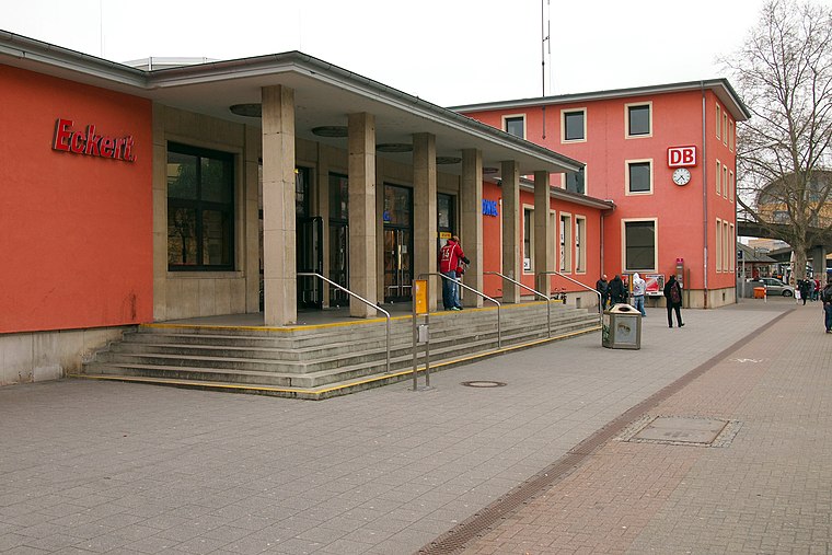
Photo: BlueBreezeWiki, CC BY-SA 3.0.
Speyer Hauptbahnhof is the more important of the two railway stations in the city of Speyer in the German state of Rhineland-Palatinate. Speyer Hauptbahnhof is situated 1½ km southeast of Erdgasanlage Speyer-Nord.
Old Cemetery
Park

Photo: BlueBreezeWiki, CC BY-SA 3.0.
Old Cemetery is a park, which is situated 2 km southeast of Erdgasanlage Speyer-Nord.
Villa Kirrmeier-Ecarius
Public building

Photo: Manuae, CC BY-SA 3.0.
Villa Kirrmeier-Ecarius is a public building, which is situated 2 km southeast of Erdgasanlage Speyer-Nord.
Places in the Area
Nearby places include Hanhofen and Römerberg.
Hanhofen
Village

Photo: Immanuel Giel, CC0.
Hanhofen is a municipality in the Rhein-Pfalz-Kreis, in Rhineland-Palatinate, Germany. Hanhofen is situated 5 km west of Erdgasanlage Speyer-Nord.
Römerberg
Village
Römerberg is a municipality in the Rhein-Pfalz-Kreis, in Rhineland-Palatinate, Germany. It is situated on the left bank of the Rhine, approximately 5 kilometres southwest of Speyer. Römerberg is situated 6 km south of Erdgasanlage Speyer-Nord.
Otterstadt
Village

Photo: Frank-m, CC BY-SA 2.5.
Otterstadt is a municipality in the Rhein-Pfalz-Kreis, in Rhineland-Palatinate, Germany. The almost 980-year-old village was once a pure agricultural and fishing village. Otterstadt is situated 6 km northeast of Erdgasanlage Speyer-Nord.
Erdgasanlage Speyer-Nord
- Type: Industry
- Location: Speyer, Palatinate, Rhineland-Palatinate, Germany, Central Europe, Europe
- View on OpenStreetMap
Latitude
49.33046° or 49° 19′ 50″ northLongitude
8.40788° or 8° 24′ 28″ eastOperator
creos DeutschlandOpen location code
8FXC8CJ5+55OpenStreetMap ID
way 1212838390OpenStreetMap feature
landuse=industrial
This page is based on OpenStreetMap, Wikidata, and Wikimedia Commons.
We’d love your help improving our open data sources. Thank you for contributing.
Satellite Map
Discover Erdgasanlage Speyer-Nord from above in high-definition satellite imagery.
Notable Places Nearby
Highlights include Sporthalle West and Waldtheater.
Nearby Places
Explore places such as Kath. Kindertagesstätte St. Christophorus and Speyer, Brucknerweg.
Palatinate: Must-Visit Destinations
Delve into Ludwigshafen, Kaiserslautern, Pirmasens, and Landau in der Pfalz.
Curious Places to Discover
Uncover intriguing places from every corner of the globe.
About Mapcarta. Data © OpenStreetMap contributors and available under the Open Database License". Text is available under the CC BY-SA 4.0 license, except for photos, directions, and the map. Photo: Wikimedia, CC0.